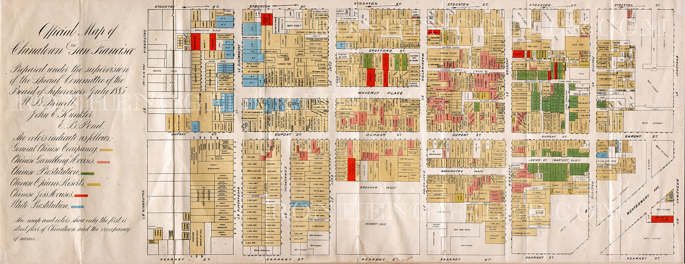
This is a very rare map of San Francisco's Chinatown in 1885. Chinatown at that time was part of the notorious Barbary Coast area, named after the dangerous ports of call on the shores of the Mediterranean.
My very special thanks to Isabelle Fritz Cope for generously allowing me to handle and scan this fragile important document. The original is framed and hanging at the BIG 4 Restaurant http://www.huntingtonhotel.com/big_restaurant/big_restaurant.cfm
in the Huntington Hotel, 1075 California Street on Nob Hill in San Francisco.
For more information on the Barbary Coast visit these sites:
Photography Index | Graphics Index | History Index
Home | Gallery | About Me | Links | Contact
© 2006 All rights reserved
The images are not in the public domain. They are the sole property of the
artist and may not be reproduced on the Internet, sold, altered, enhanced,
modified by artificial, digital or computer imaging or in any other form
without the express written permission of the artist. Non-watermarked copies of photographs on this site can be purchased by contacting Ron.