RON HENGGELER |
June 3, 2006
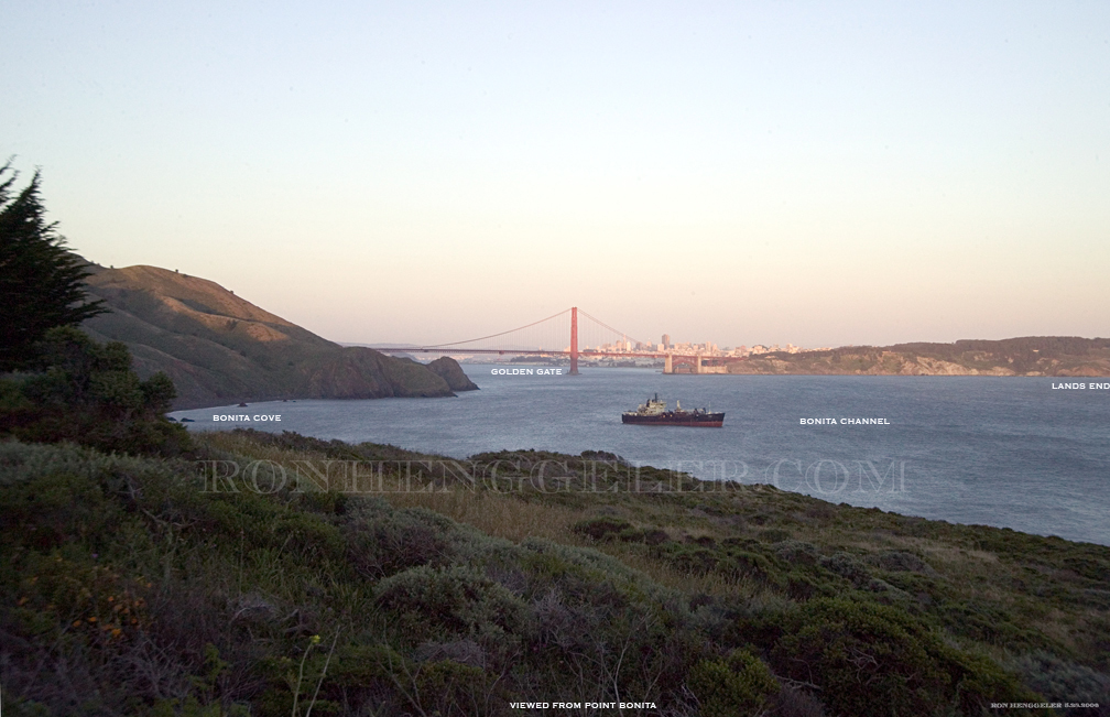
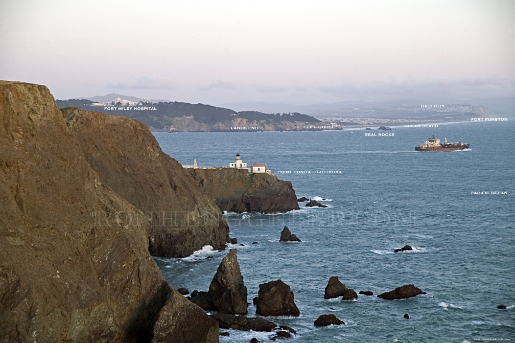
Point Bonita Lighthouse at the mouth of the Gate
BONITA CHANNEL
Ocean channel at northwest entrance to the Golden Gate between Point Bonita and Four Fathom Bank. South entrance of channel lies with San Francisco County. Named for adjacent point, named Punta Bonete in 1790's by the Spanish for its resemblance in profile (from east or west) to a wide brimmed clerical hat or "bonete". Altered by American usage to "bonita," Spanish for pretty.
BONITA COVE
Large northwest cove of the Golden Gate whose shore is part of the border of San Francisco County. Named for the point. Also called Rialto Cove for a 19th century salvaged shipwreck.
GOLDEN GATE
Major straight linking San Francisco Bay to the Pacific Ocean. Low water level along its north shore forms part of the boundary of San Francisco County. Named by explorer/soldier Col. John C. Freemont in 1848. He envisioned it as the entrance to a great future port city and named it "Chrysopylae" or "Golden Gate" in reference to the Graeco-Byzantine "Chrysoceras" or "Golden Horn," the harbor of Constantinople. The name was popularized worldwide by the 1849 California Gold Rush. The Indian name was Yulupa, possibly meaning "sunset place". The Spanish names were Entrada del Puerto ("port entrance"), Boca del Puerto ("port mouth"), and La Boca ("the mouth"). American mariners' name of the 19th century was Hole in the Wall, a reference to the straight as a break through the coast ranges. The southern bay is South Bay, formerly South Bight (1870s) and Fatality Bay for its many shipwrecks. The narrow eastern neck where the bridge crosses is The Narrows. The 350-foot-deep central depression is called Deep Hole by Fisherman.
LANDS END
A prominent headlands bluff in Lincoln Park at the south west entrance of the Golden Gate. It was named in 1827 as a general reference to the entire headlands. The Spanish name for the bluff was Punta Angel de la Guarda "guardian angel point". The bluff was also known as Point Lobos from 1826 to the 1860s, when the present name was attached to the specific point. It is located north of Fort Miley and a northern extension of 44th Avenue.
The text explaining the names is respectfully taken from the SAN FRANCISCO ALMANAC by Gladys Hansen. My copy is published by Chronicle Books in 1995. A fun-facts-filled informative book that I highly recommend. Gladys Hansen is also responsible for one of the best web sites on San Francisco’s history. It’s easy to get lost in this amazing web site.
http://www.sfmuseum.org/
|
|
Newsletters Index: 2015, 2014, 2013, 2012, 2011, 2010, 2009, 2008, 2007, 2006
Photography Index | Graphics Index | History Index
Home | Gallery | About Me | Links | Contact
© 2015 All rights reserved
The images are not in the public domain. They are the sole property of the
artist and may not be reproduced on the Internet, sold, altered, enhanced,
modified by artificial, digital or computer imaging or in any other form
without the express written permission of the artist. Non-watermarked copies of photographs on this site can be purchased by contacting Ron.