RON HENGGELER |
October 30, 2012
Bay Area views from atop Mt Tam
These photos were taken on Monday from the summit of Mt. Tamalpais
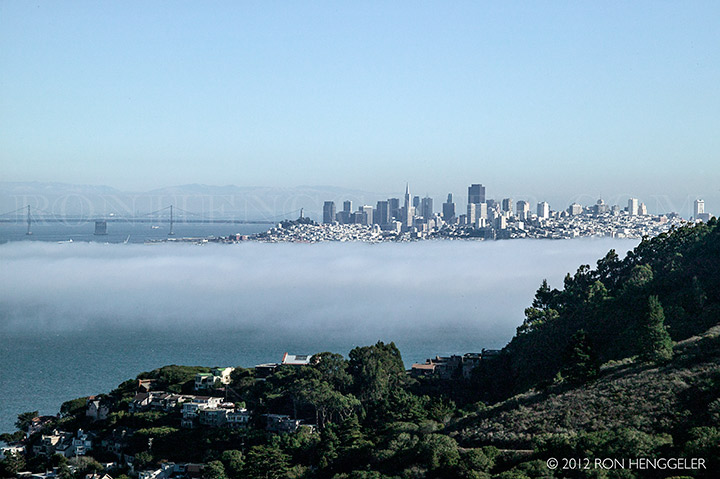
San Francisco and the fog, seen from the Highway 101, while driving to Mt Tamalpais State Park |
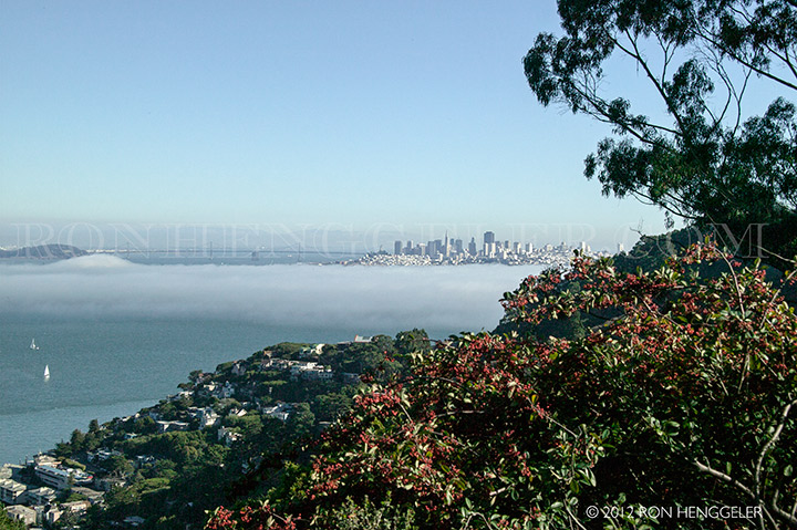
San Francisco and the fog, seen from the Highway 101, near Sausalito |
A view of the Marin Headlands and the distant San Francisco, seen from the summit road on Mt Tamalpais |
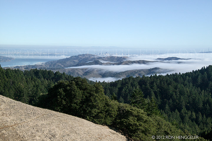
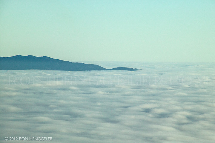
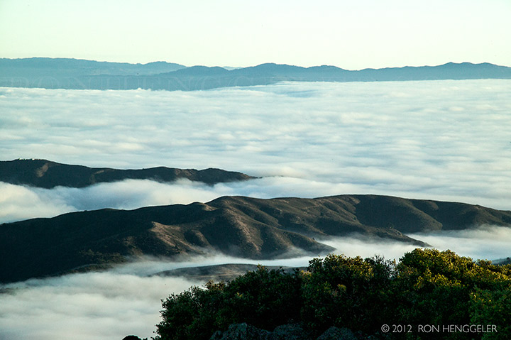
The fog in the Marin Headlands and the distant San Francisco, seen from Mt Tamalpais |
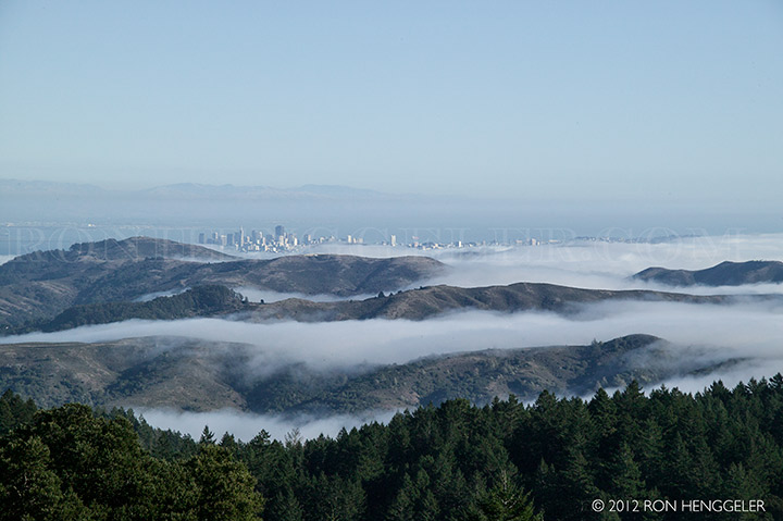
The marine layer fog, the Marin Headlands, and the distant San Francisco, seen from Mt Tamalpais |
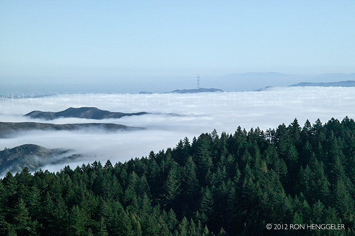
The marine layer coming in through the Gate, and the distant Sutro Tower and Twin Peaks in San Francisco |
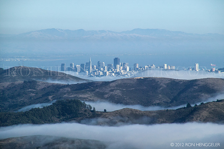
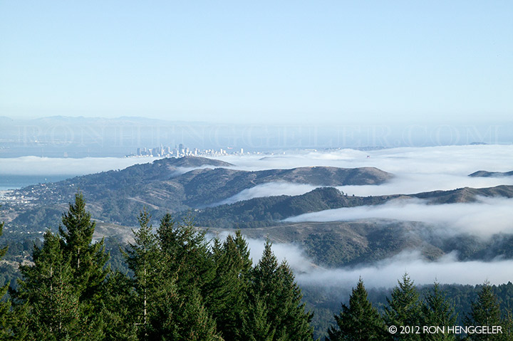
San Francisco and the fog, seen from Mt Tamalpais |
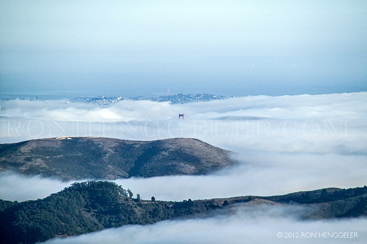
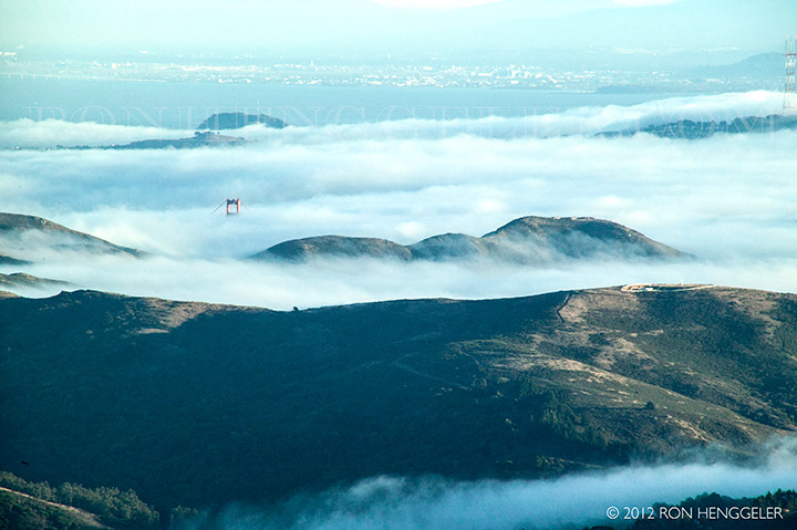
Peeking through the fog, the top of the north tower of the Golden Gate Bridge |
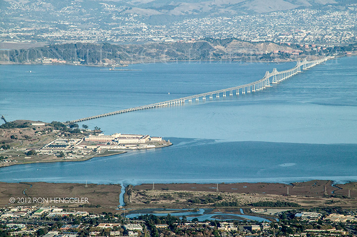
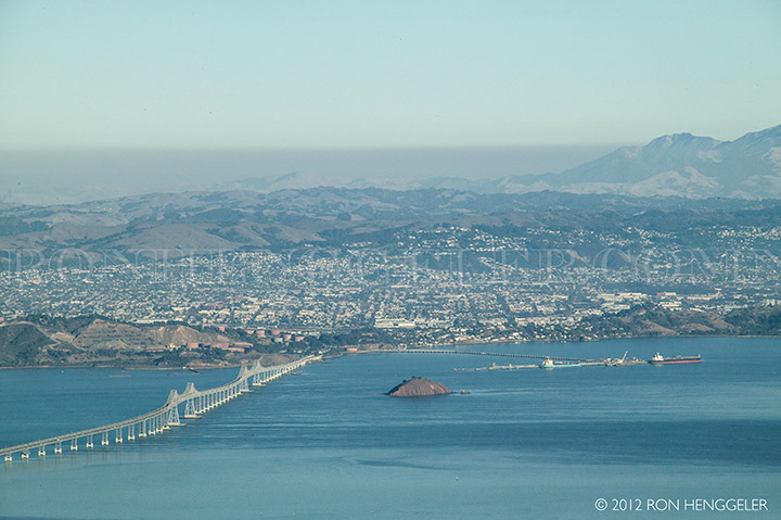
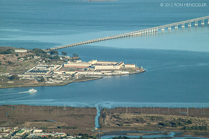
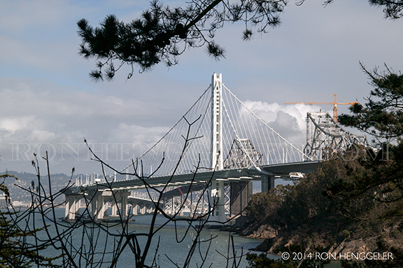
The Richmond-San Rafael Bridge, with San Quentin Prison on the shore at the left, seen from atop Mt Tamalpais |
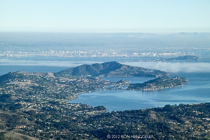
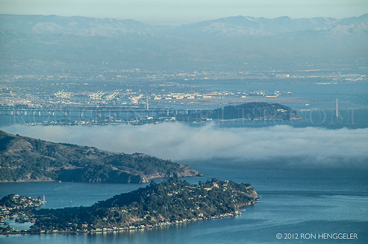
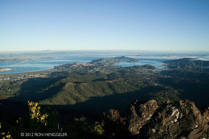
Richardson Bay, Belvedere, Tiburon, and Angel Island, seen from atop Mt Tamalpais |
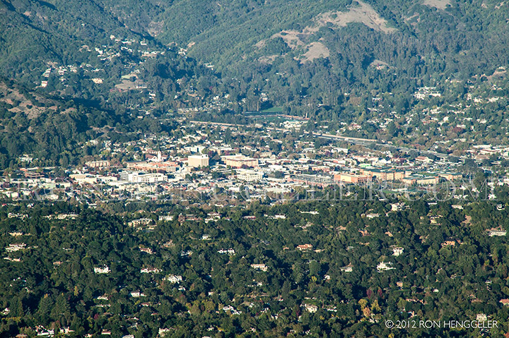
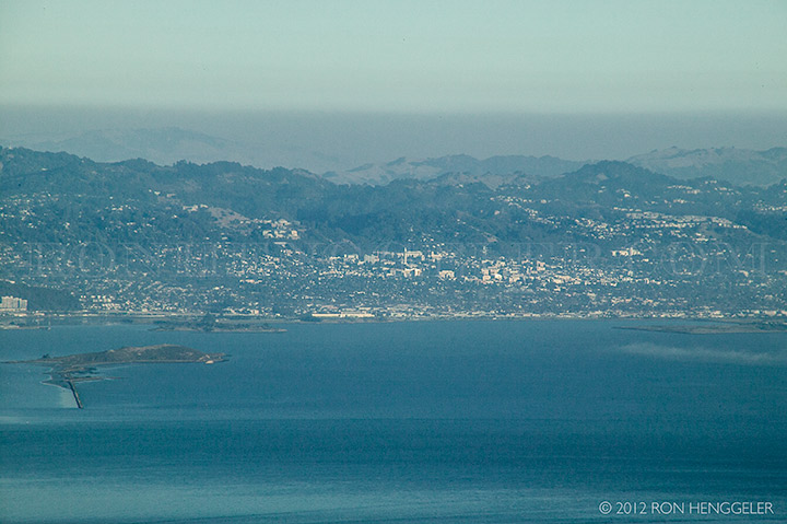
San Rafael seen from atop Mt Tamalpais |
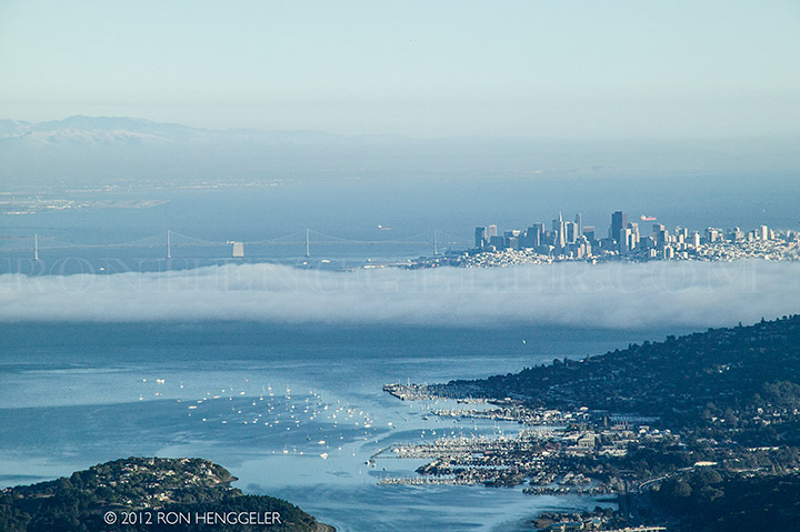
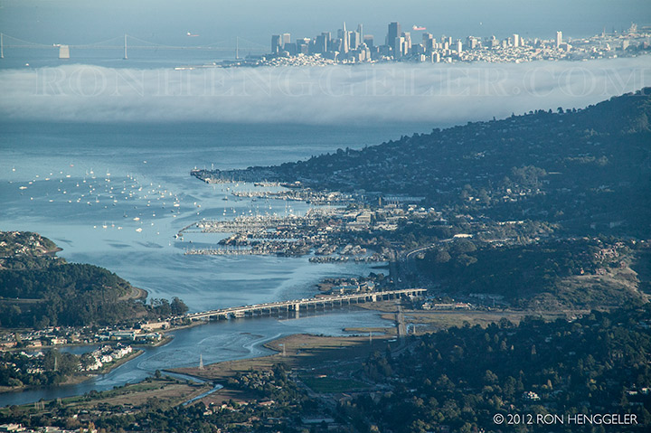
The Sausalito Marina, the fog, and San Francisco, seen from atop Mt Tamalpais |
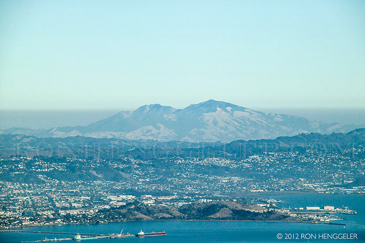
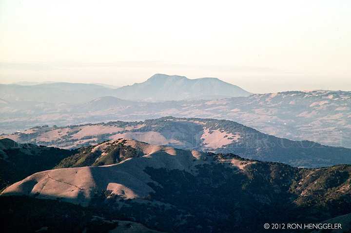
Mt Diablo seen from atop Mt Tamalpais |
The city of Richmond and the Richmond-San Raphael Bridge, seen from atop Mt Tamalpais |
Richardson Bay and the Sausalito Marina seen from atop Mt Tamalpais |
Belvedere at the bottom with Yerba Buena Island in the center, seen from atop Mt Tamalpais |
San Quentin Prison, seen from atop Mt Tamalpais |
The city of Berkeley and the Berkeley Hills, seen from atop Mt Tamalpais |
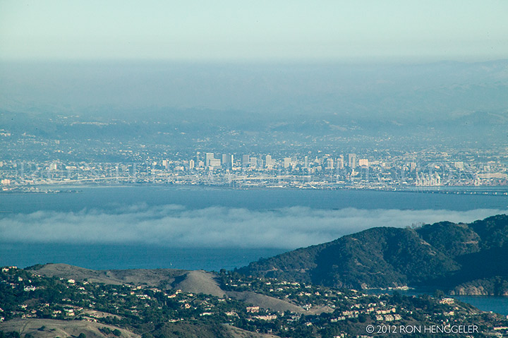
The city of Oakland, seen from atop Mt Tamalpais |
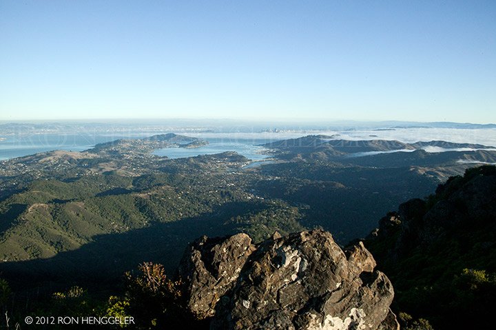
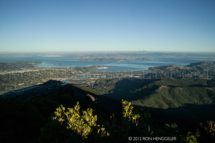
The Bay Area to the north of San Francisco, seen from atop Mt Tamalpais |
The Bay Area seen from atop Mt Tamalpais, with Mt Diablo to the left on the horizon |
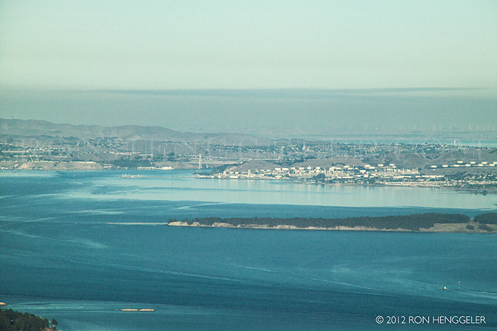
San Pablo Bay, Benicia, Phillips 66 San Francisco Refinery, and the Carquinez Bridge, seen from atop Mt Tamalpais |
Text |
The shadow of Mt Tamalpais with far-distant Mt Diablo on the horizon, seen from atop Mt Tamalpais |
Looking south towards Pacifica, the marine layer covers the Gate and the Pacific Ocean, seen from atop Mt Tamalpais |
The north tower of the Golden Gate Bridge peeks out of the fog, seen from atop Mt Tamalpais |
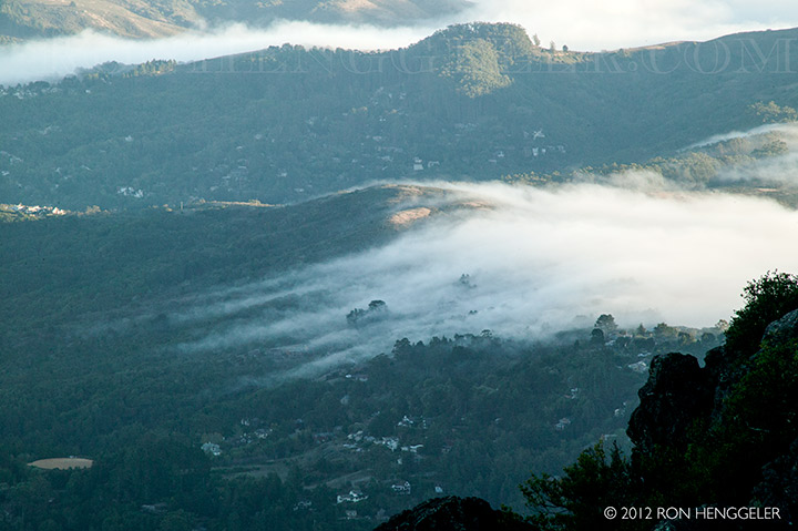
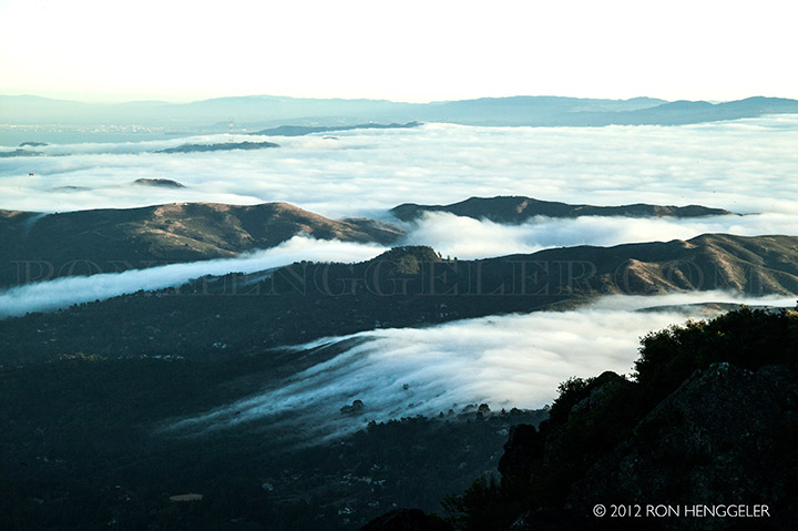
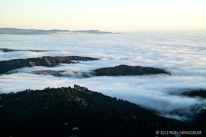
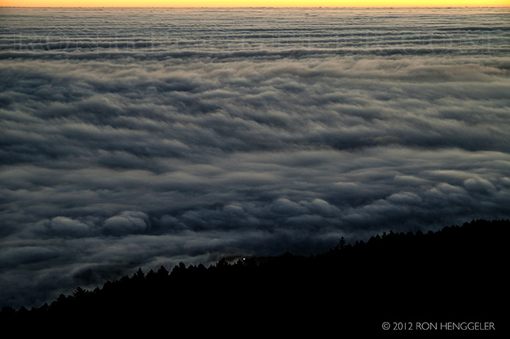
The marine layer fog passing through the Tennessee Valley, seen from atop Mt Tamalpais |
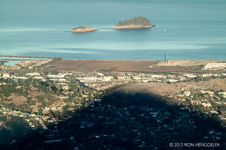
The shadow of Mt Tamalpais, and the Marin Island National Wildlife Refuge, as seen from atop Mt Tamalpais |
The fog at the Gate and in the Tennessee Valley, as seen from atop Mt Tamalpais |
The fog at the Gate and in the Tennessee Valley, as seen from atop Mt Tamalpais |
Mt Saint Helena, as seen from atop Mt Tamalpais |
Tennessee Valley, the Gate, and the far-distant Pacifica, as seen from atop Mt Tamalpais |
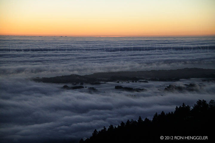
After sunset, a thick marine layer blankets the Pacific Ocean, as seen from the West Ridgecrest Road on Mt Tamalpais |
A barely visible Bolinas showing through the marine layer that blankets the ocean, as seen from the West Ridgecrest Road on Mt Tamalpais |
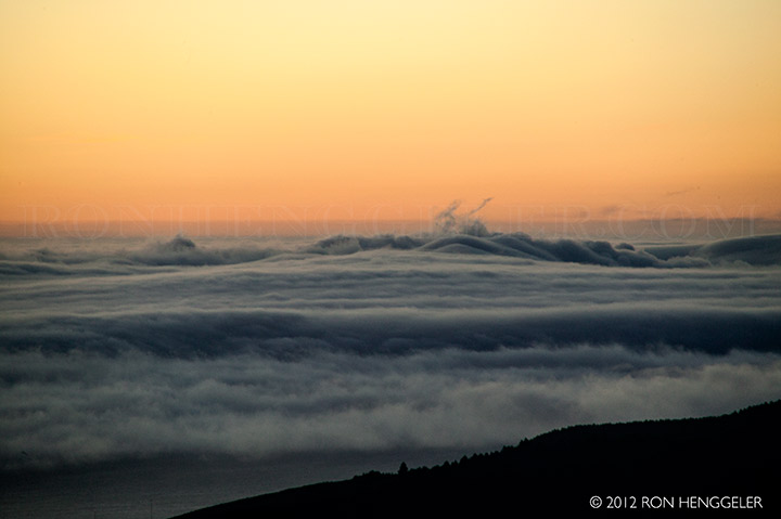
A bounce in the marine layer as it hits up against the Point Reyes to the far north, as seen from the West Ridgecrest Road on Mt Tamalpais |
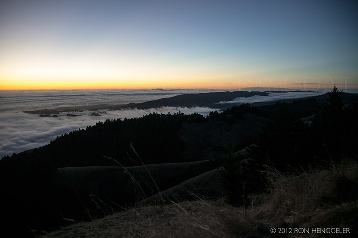
After sundown, looking south to the Gate shrouded in fog, as seen from the West Ridgecrest Road on Mt Tamalpais |
A single light showing through the marine layer of fog indicates Stinson Beach far below, as seen from the West Ridgecrest Road on Mt Tamalpais |
The Olema Valley and the far-distant Point Reyes, as seen from the West Ridgecrest Road Mt Tamalpais |
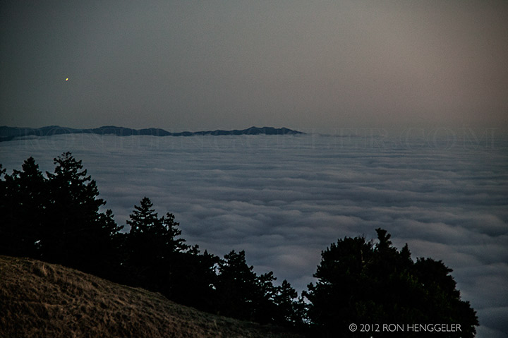
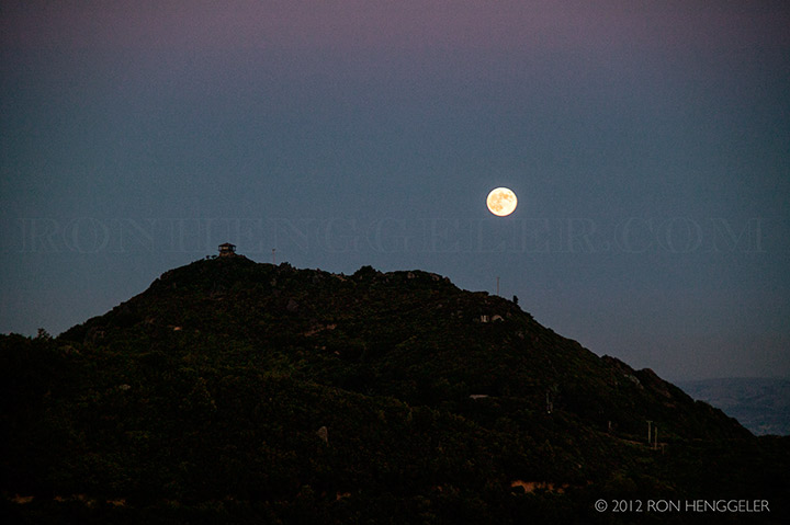
The full moon and the Lookout Fire Station at the summit of Mt Tamalpais East Peak |
Newsletters Index: 2015, 2014, 2013, 2012, 2011, 2010, 2009, 2008, 2007, 2006
Photography Index | Graphics Index | History Index
Home | Gallery | About Me | Links | Contact
© 2015 All rights reserved
The images are not in the public domain. They are the sole property of the
artist and may not be reproduced on the Internet, sold, altered, enhanced,
modified by artificial, digital or computer imaging or in any other form
without the express written permission of the artist. Non-watermarked copies of photographs on this site can be purchased by contacting Ron.