RON HENGGELER |
June 23, 2013
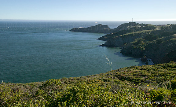
Old bunkers and gun batteries, and the Point Bonita Lighthouse
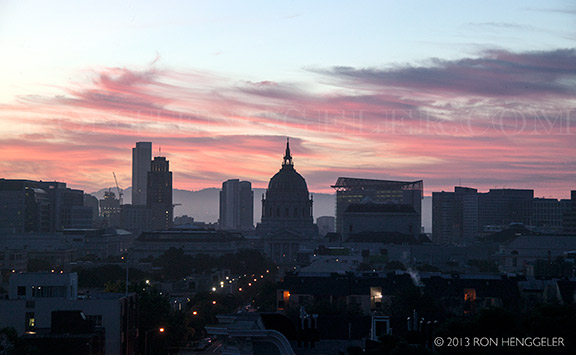
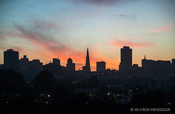
Sunrise from my window on Summer Solstice, June 21, 2013 |
Sunrise from my window on Summer Solstice, June 21, 2013 |
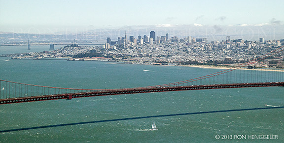
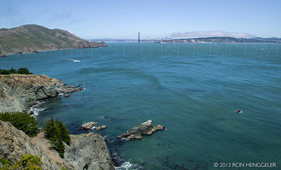
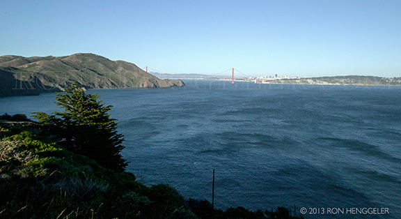
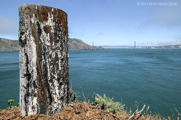
The view the Golden Gate and distant San Francisco from Hawk Hill in the Marin Headlands. |
The view the Golden Gate and distant San Francisco from Hawk Hill in the Marin Headlands. |
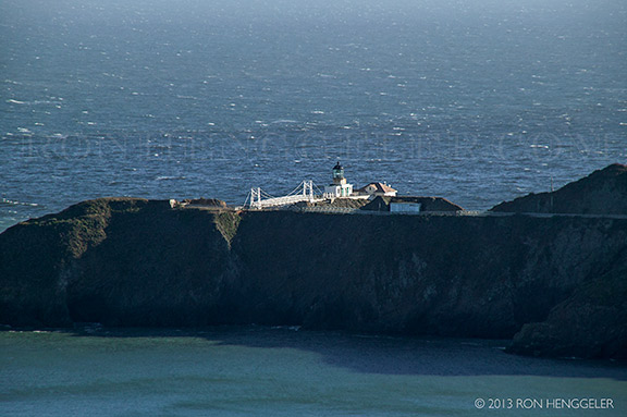
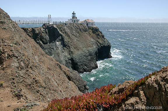
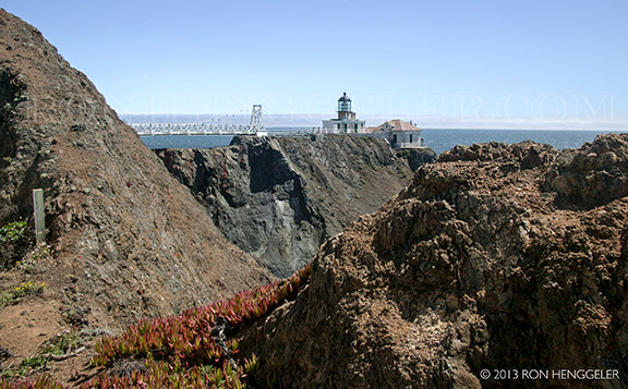
The Point Bonita Lighthouse viewed from on the Conzelman Road in the Marin Headlands. |
The Gate, and the distant Golden Gate Bridge viewed from Point Bonita |
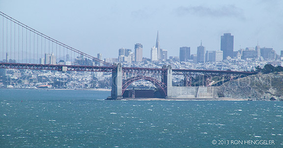
Fort Point, the Golden Gate Bridge, and San Francisco, as seen with a 300mm lens from Point Bonita |
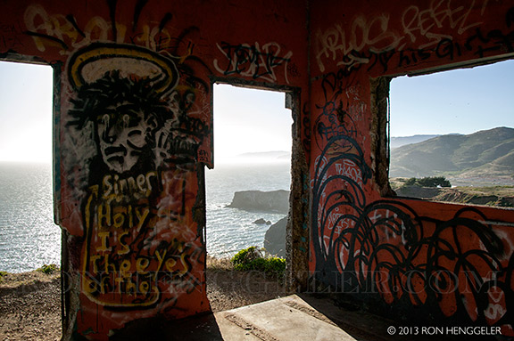
The ruins of a World War 2 bunker high atop a coastal cliff overlooking Bird Rock and Point Bonita. |
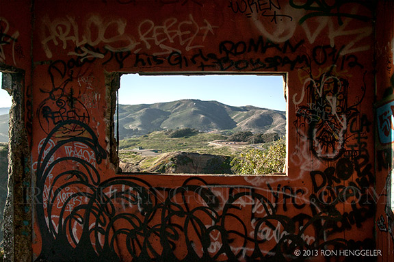
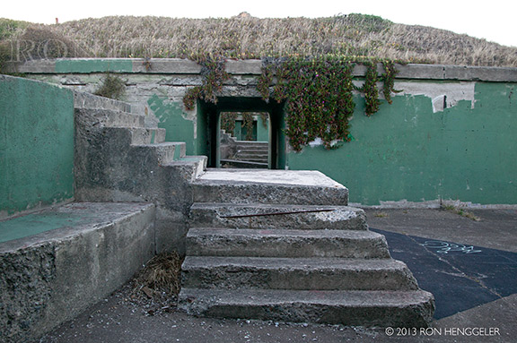
Inside the ruins of a World War 2 bunker, high atop a coastal cliff overlooking Bird Rock and Point Bonita. |
Inside the ruins of a World War 2 bunker, high atop a coastal cliff overlooking Bird Rock and Point Bonita. |
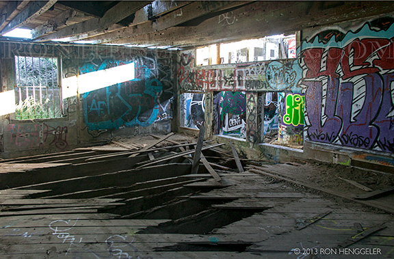
Inside the ruins of a World War 2 bunker. |
The ruins of a World War 2 bunker, high atop a coastal cliff at Point Bonita, in the Marin Headlands |
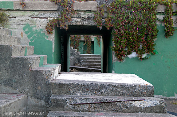
Inside the ruins of the World War 2 bunker (pictured above), high atop a coastal cliff at Point Bonita, in the Marin Headlands. |
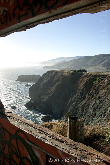
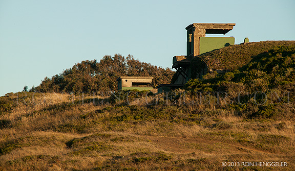
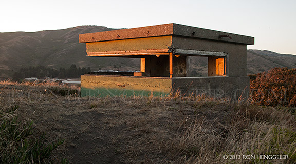
A World War 2 lookout post high atop a coastal cliff at Point Bonita, in the Marin Headlands. |
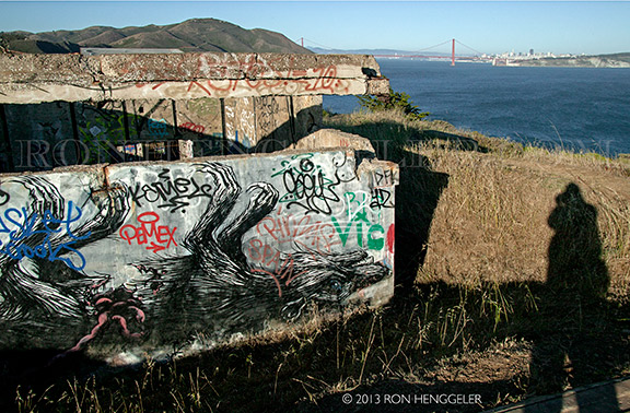
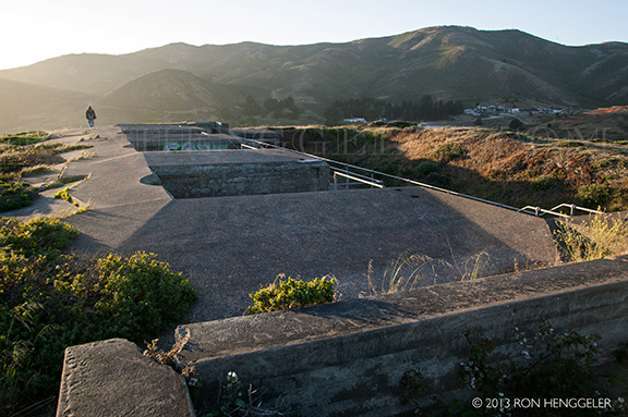
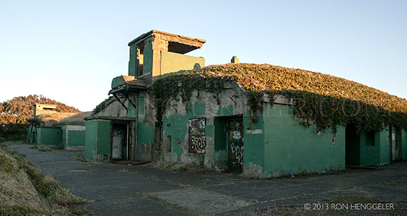
The ruins of a World War 2 battery, overlooking Rodeo Lagoon and Rodeo Beach in the Marin Headlands |
The ruins of a World War 2 battery, overlooking Rodeo Lagoon and Rodeo Beach in the Marin Headlands |
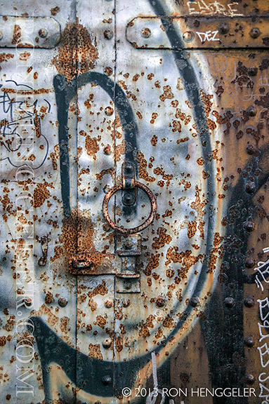
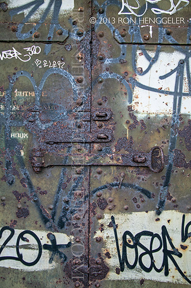
Detail of a rusted steel door of a World War 2 gun battery in the Marin Headlands |
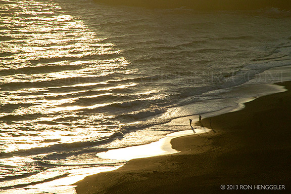
Rodeo Beach seen from the ruins of a World War 2 battery situated high atop a coastal ridge in the Marin Headlands |
The ruins of a World War 2 battery situated high atop a coastal ridge in the Marin Headlands. |
Detail of a rusted steel door of a World War 2 gun battery in the Marin Headlands |
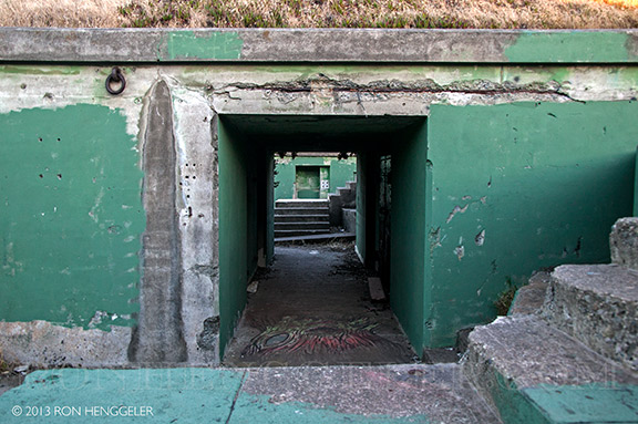
The ruins of a World War 2 battery situated high atop a coastal ridge in the Marin Headlands |
The ruins of a World War 2 battery situated high atop a coastal ridge in the Marin Headlands |
World War 2 battery in the Marin Headlands |
World War 2 battery in the Marin Headlands |
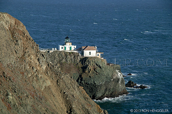
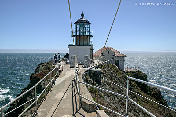
For over 150 years, Point Bonita Lighthouse has aided ships navigating the treacherous waters of the Golden Gate. |
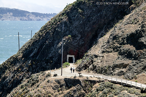
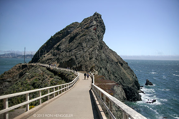
The Point Bonita Lighthouse is reached by a half-mile trail that is steep in parts. |
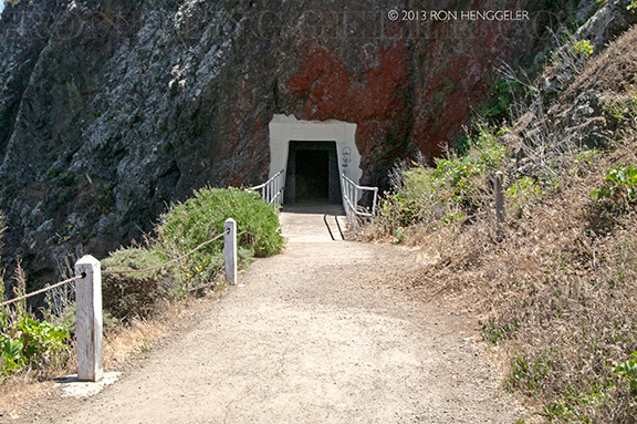
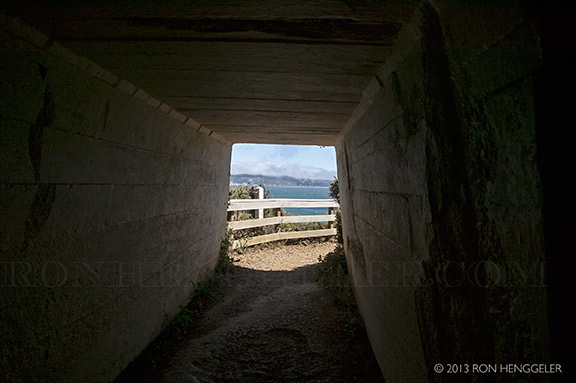
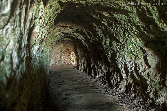
The tunnel halfway to the lighthouse is open only during visiting hours: Saturdays, Sundays and Mondays from 12:30 p.m. to 3:30 p.m. |
In the early 1850's, when lighthouse construction began, there was still no marker at Point Bonita. In 1853 the steamship Tennessee ran aground just north of Point Bonita (at what is now Tennessee Cove). The clipper ship San Francisco struck the rocks of Point Bonita and sank in 1854. |
Point Bonita Lighthouse, the third lighthouse on the West Coast, was completed in 1855. Built upon a high ridge 300 feet above the water, there were soon complaints that thick fog frequently obscured the light beam. A new site at a lower elevation was chosen near- by at the tip of Point Bonita. |
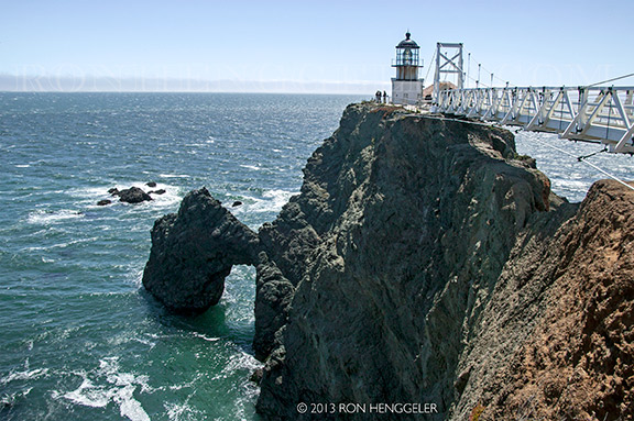
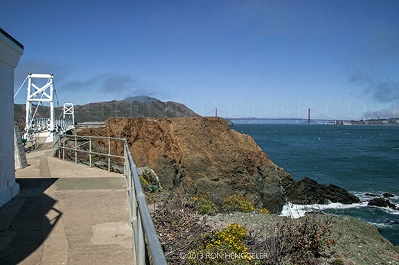
The spectacular Golden Gate, entrance to San Francisco Bay, seen from the Point Bonita Lighthouse. |
Point Bonita is located at the northern entrance to the San Francisco Bay. The original name was in fact "Point Boneta" - a reference to the resemblance of the area hills to the hats worn by Spanish religious officials. (Early lighthouse plans are still labeled "Point Boneta.") |
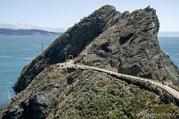
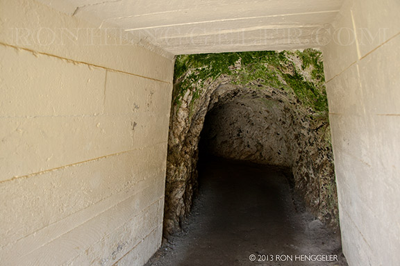
A tunnel was cut through the rock to allow more direct access to the point. |
In the late 19th century, Chinese laborers carved out this tunnel by hand. |
Looking through the tunnel going to the lighthouse |
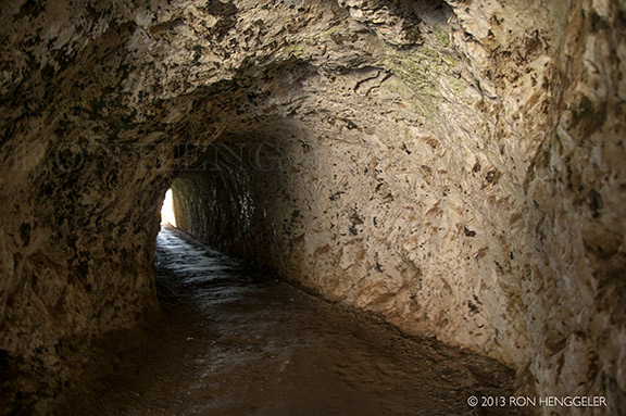
Inside the tunnel looking at the far-distant Point Lobos near the Cliff House, on the San Francisco side of the Gate |
A view of San Francisco and the Golden Gate Bridge seen from the lighthouse tunnel entrance |
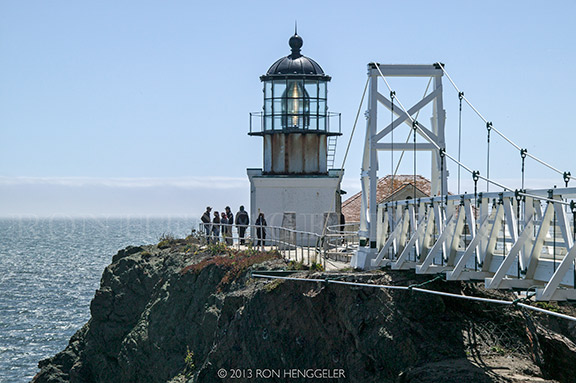
In 1854, difficult work began on a lighthouse situated on the highest hill in the area - 260 feet above sea level. The point was very difficult to reach. The point was at the top of 50-foot cliffs, and the breakers from the Pacific side of the point are quite powerful. The first local contractor backed out of the job. A second firm completed the task - a California-cottage style dwelling, with a separate tower. The 56-foot high tower housed a fixed second-order Fresnel lens, the most powerful beacon of the San Francisco Bay. The lamp was lit for the first time on May 2, 1855. |
As with many lighthouses of the area, fog was a major problem. High above the point, the lighthouse was often obscured by high fog. A surplus cannon was acquired from the Benicia Arsenal and a new keeper, Sgt. Edward Maloney, was hired to fire the cannon as a fog signal. The assignment proved very difficult, due to the frequency of fog in the area. Maloney once fired the cannon for three days, resting for only two hours. The cannon was also difficult to hear, and gunpowder was expensive. A fog bell with an automated clockwork was finally installed in 1856. |
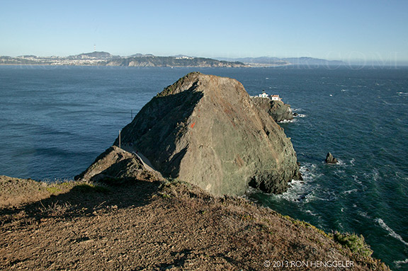
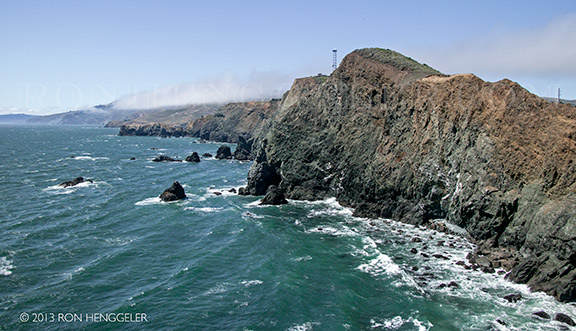
Difficulties in sighting the original light led the Lighthouse Service in the 1870's to move the light from the top of the hill to Land's End - the far end of the point itself. This is the most difficult area of Point Bonita to traverse, due to its steep cliffs and narrow paths. Huge breakers and rockslides were not uncommon. The first difficult steps in building a new lighthouse involved simply cutting a path to Land's End! |
The view looking down to the water on the south side of the lighthouse |
In the 1920's, Point Bonita's lamp was switched from a fixed to an osculating lens. |
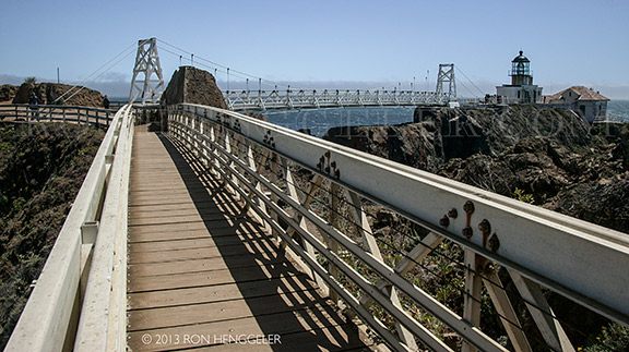
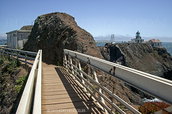
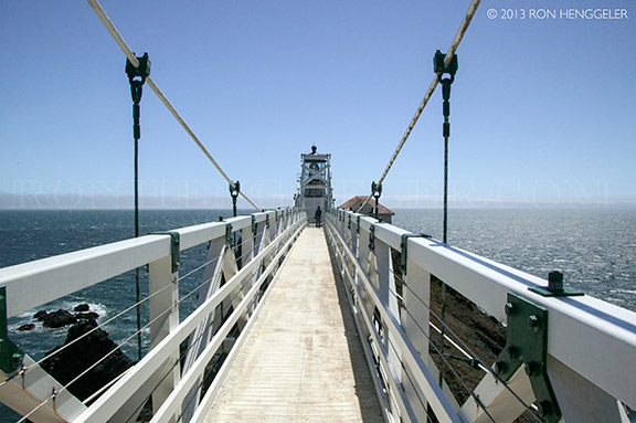
Up until 1940 the lighthouse could be reached without a bridge, but erosion caused a trail leading to the lighthouse to crumble into the sea. A wooden walkway was installed, but when that became treacherous the suspension bridge was built in 1954. |
In the 1960's, the Coast Guard closed the station to the public. Compressed air horns had long replaced the old fog signals. By 1979, Point Bonita was the last manned lighthouse in California. The light was automated shortly afterwards. The station, while still maintained by the Coast Guard, was handed over to the National Parks Service as Park of the Golden Gate National Recreational Area. The Parks Service re-opened the station to visitors. The original second-order Fresnel lens still graces the tower. |
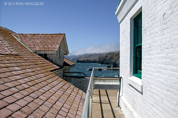
A view from the south side of the Point Bonita Lighthouse |
A view from the north side of the Point Bonita Lighthouse |
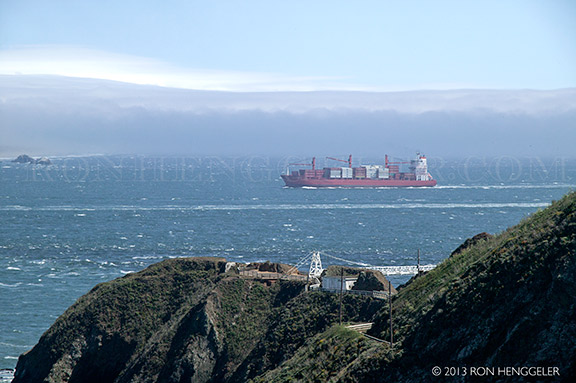
A view from the bridge near the lighthouse, looking north towards Tennessee Valley, Muir Beach, Stinson Beach, Bolinas, and Point Reyes over 30 miles away up the coast |
Difficulties in sighting the original light led the Lighthouse Service in the 1870's to move the light from the top of the hill to Land's End - the far end of the point itself. This is the most difficult area of Point Bonita to traverse, due to its steep cliffs and narrow paths. Huge breakers and rockslides are not uncommon. |
After visiting the Point Bonita Lighthouse, a reversed view inside the tunnel |
Despite the effectiveness of the lighthouses, over 300 boats ran aground near the Golden Gate during the gold rush years. The worst maritime disaster occurred in 1901, when the steamer City of Rio de Janeiro struck Point Diablo, near Point Bonita. Despite approaching in darkness and continued fog, the pilot was pressured by an influential passenger to proceed. The lives of 128 passengers were lost when the City of Rio de Janeiro struck rocks, quickly filled with water and sank to the bottom of the Bay. |

Newsletters Index: 2015, 2014, 2013, 2012, 2011, 2010, 2009, 2008, 2007, 2006
Photography Index | Graphics Index | History Index
Home | Gallery | About Me | Links | Contact
© 2015 All rights reserved
The images are not in the public domain. They are the sole property of the
artist and may not be reproduced on the Internet, sold, altered, enhanced,
modified by artificial, digital or computer imaging or in any other form
without the express written permission of the artist. Non-watermarked copies of photographs on this site can be purchased by contacting Ron.