RON HENGGELER |
October 25, 2014
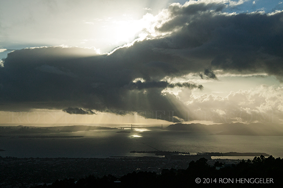
Storm clouds at sunset above the Golden Gate
On Monday October 20th, Dave and I drove over to the East Bay for a visit to Berkeley’s Botanical Gardens.
On the drive over the Bay Bridge, we detoured onto Yerba Buena Island to view the deconstruction of the old cantilevered span of the Bay Bridge that is now under way. After the visit to the Gardens, we drove up to the Grizzly Peak Road to watch the sun go down. On Sunday night, the Bay Area had had its first rain storm in over a year of dire drought conditions. The storm clouds were still coming in from the Pacific at dusk on Monday, and they made for a spectacular sunset. These are some of the photos from the day.
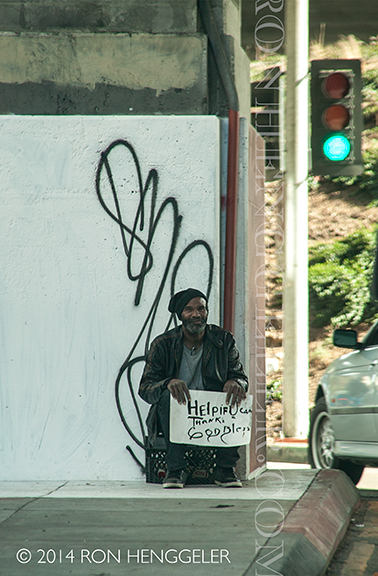
A homeless man in San Francisco, panhandling at the onramp of the San Francisco-Oakland Bay Bridge |
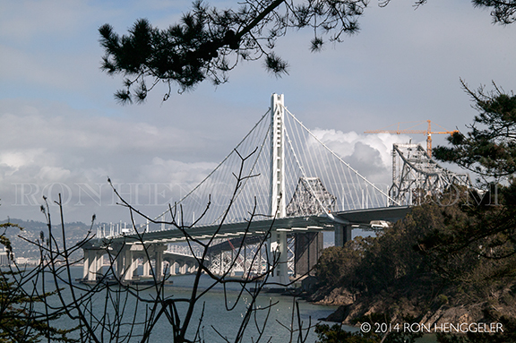
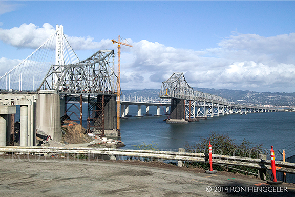
A view from Yerba Buena Island of the new eastern span of the Bay Bay Bridge, with a glimpse the old span behind it. |
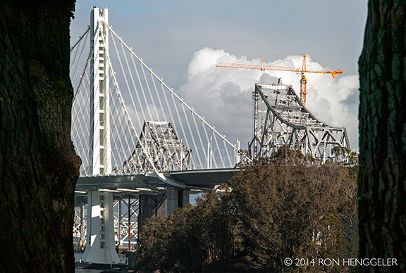
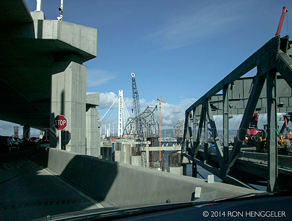
A glimpsed view between eucalyptus trees of the new Bay Bridge’s tower, and the old cantilevered span of the Bay Bridge being deconstructed |
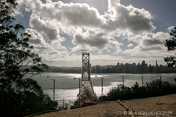
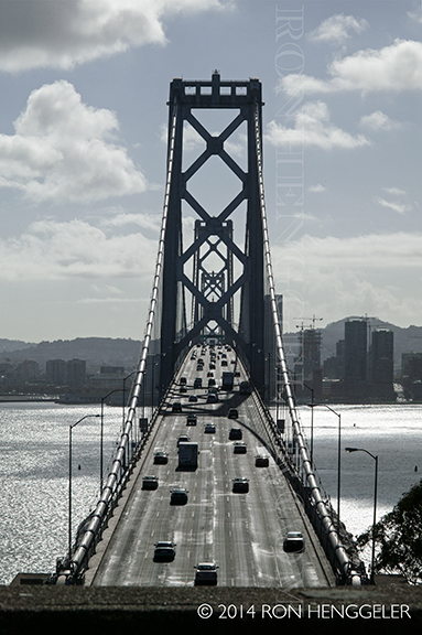
The western span of the Bay Bridge as seen from the summit of Yerba Buena Island |
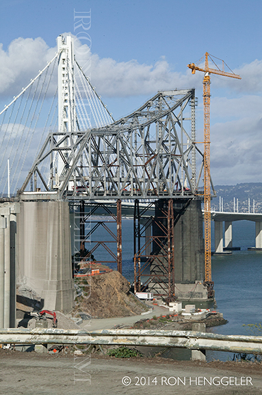
The old and new eastern spans of the Bay Bridge as seen from the summit of Yerba Buena Island |
The roadway of the western span with traffic flowing into San Francisco |
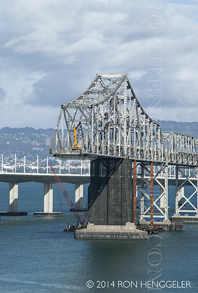
A view of the old cantilevered span of the Bay Bridge being deconstructed as seen from the near the shoreline of Yerba Buena Island |
A view of the old cantilevered span of the Bay Bridge being deconstructed as seen from the near the shoreline of Yerba Buena Island |
A view of the old cantilevered span of the Bay Bridge being deconstructed as seen from the near the shoreline of Yerba Buena Island |
A view of the old cantilevered span of the Bay Bridge being deconstructed as seen from the entrance onto the bridge from Yerba Buena Island |
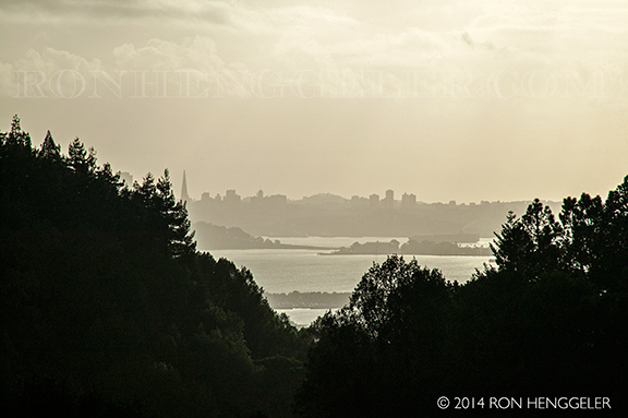
A glimpsed view of San Francisco across the bay as seen as seen with a 300mm lens, from the Old World Rose Garden inside the Berkeley Botanical Gardens |
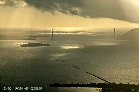
The entrance to San Francisco Bay, the Golden Gate Bridge, and Alcatraz Island, as seen with a 300mm lens from the Grizzly Peak Road high atop the Berkeley Hills. |
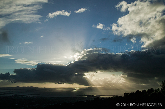
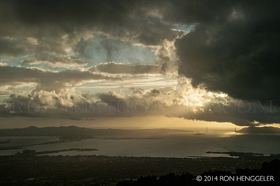
Sunset at the Golden Gate with storm clouds as seen from the Grizzly Peak Road high atop the Berkeley Hills. |
Sunset at the Golden Gate with storm clouds as seen from the Grizzly Peak Road high atop the Berkeley Hills. |
The United States seized the region from Mexico during the Mexican-American War (1846–1848). On February 2, 1848 California was annexed to the U.S. with the signing of the Treaty of Guadalupe Hidalgo. A year and a half later, California requested to join the United States on December 3, 1849 and was accepted as the 31st State of the union on September 9, 1850. |
The bay became the center of American settlement and commerce in the Far West through most of the remainder of the 19th century. During the California Gold Rush (1848-1855), San Francisco Bay suddenly became one of the world's great seaports, dominating shipping in the American West until the last years of the 19th century. The bay's regional importance increased further when the First Transcontinental Railroad was connected to its western terminus at Alameda on September 6, 1869. The terminus was switched to the Oakland Long Wharf two months later on November 8, 1869. |
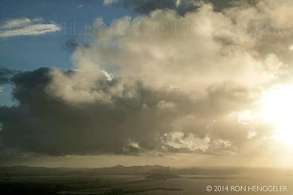
Storm clouds over Yerba Buena Island and San Francisco as seen from the Grizzly Peak Road high atop the Berkeley Hills. |
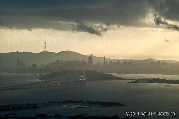
Storm clouds over San Francisco at sundown, as seen from the Grizzly Peak Road high atop the Berkeley Hills. |
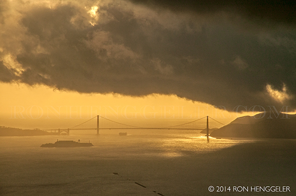
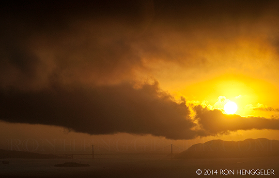
Storm clouds over the Golden Gate Bridge at sundown, as seen from the Grizzly Peak Road high atop the Berkeley Hills. |
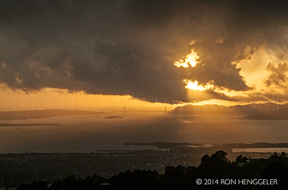
Storm clouds over the San Francisco Bay Area at sunset, as seen from the Grizzly Peak Road high atop the Berkeley Hills. |
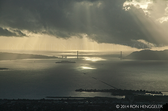
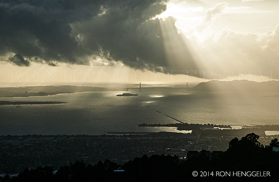
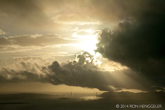
The setting sun and storm clouds over the Golden Gate Bridge and Marin Headlands, seen with a 300mm lens. |
The setting sun and storm clouds over the Golden Gate Bridge and Marin Headlands, as seen from the Grizzly Peak Road high atop the Berkeley Hills. |
For a fleeing moment, the storm clouds break to reveal the setting sun at the Gate. |
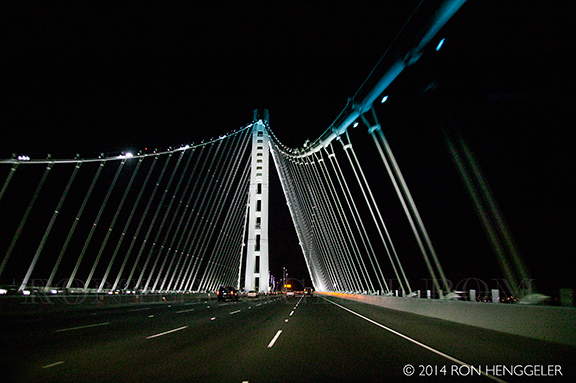
Crossing the new Bay Bridge at night on the way back home to San Francisco. |
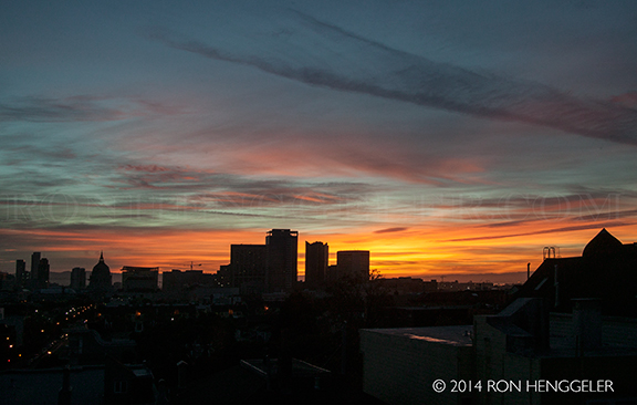
Sunrise on Tuesday morning, from my window |
Newsletters Index: 2015, 2014, 2013, 2012, 2011, 2010, 2009, 2008, 2007, 2006
Photography Index | Graphics Index | History Index
Home | Gallery | About Me | Links | Contact
© 2015 All rights reserved
The images are not in the public domain. They are the sole property of the
artist and may not be reproduced on the Internet, sold, altered, enhanced,
modified by artificial, digital or computer imaging or in any other form
without the express written permission of the artist. Non-watermarked copies of photographs on this site can be purchased by contacting Ron.