RON HENGGELER |
November 27, 2016
The Point Bonita Lighthouse, and a close encounter with a coyote, in the Marin Headlands
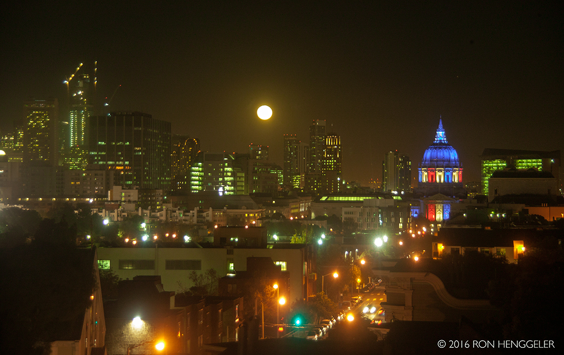
Last Monday, November 14th, the day of the super full moon, Dave and I visited the historic Point Bonita Lighthouse in the Marin Headlands north of San Francisco.
Following the November 14th afternoon visit to the Point Bonita Lighthouse, we returned home to a view from my window of the super full moon rising. |
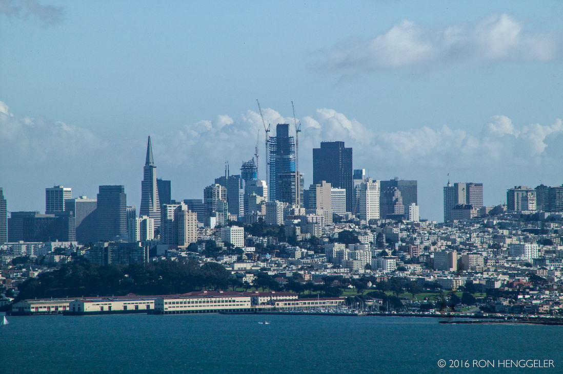
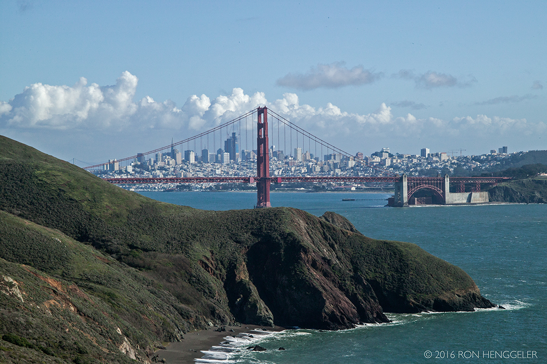
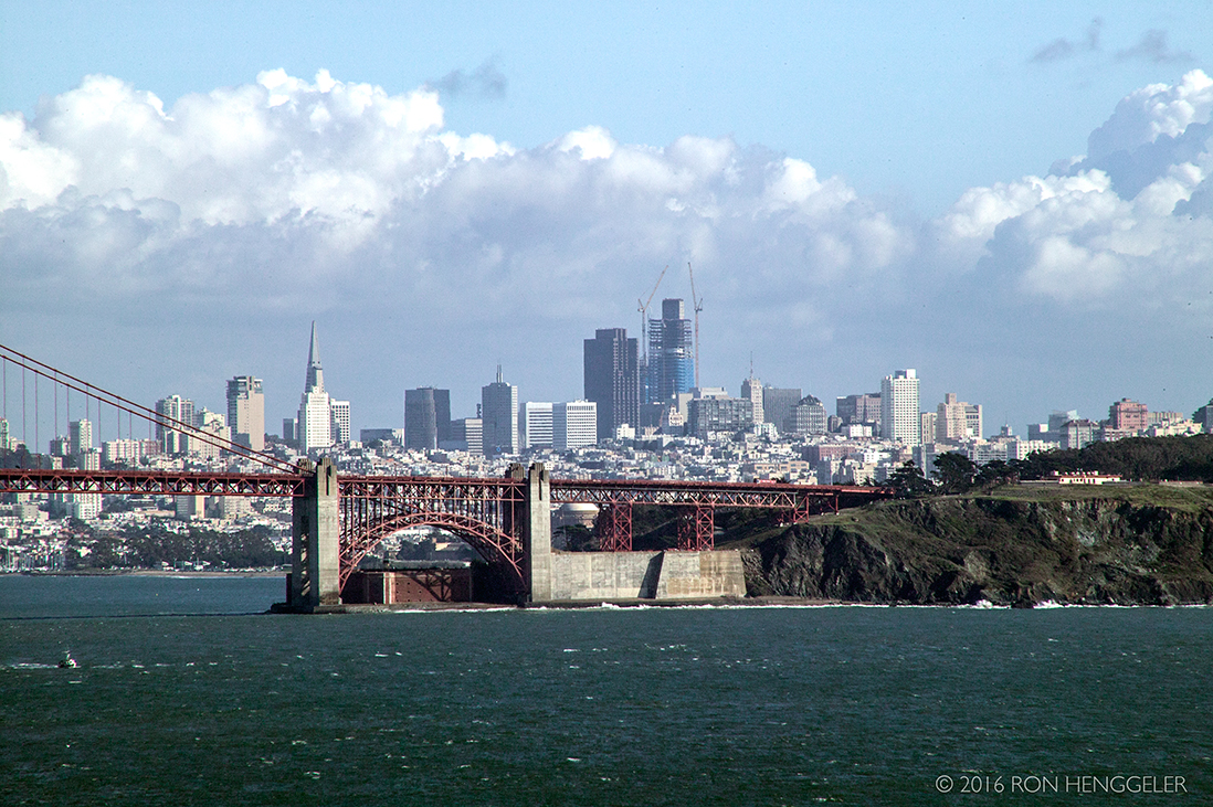
A 300mm lens view from the Marin Headlands of the far-distant San Francisco skyline and showing the Salesforce Tower under construction |
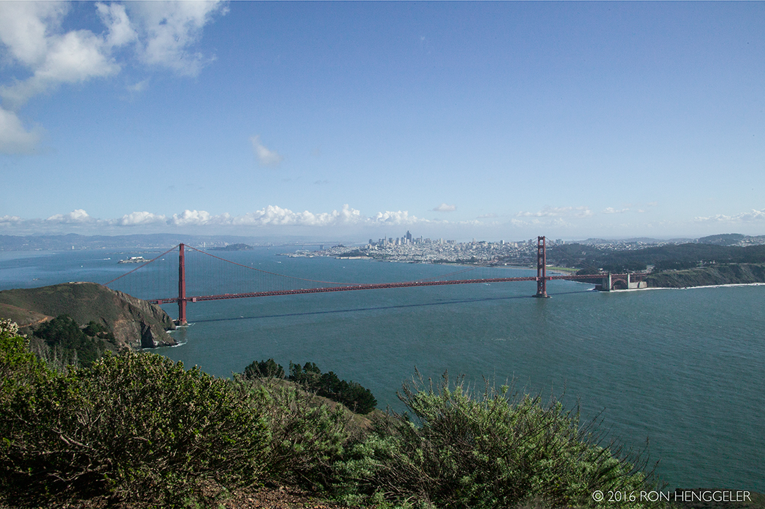
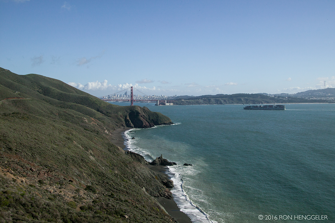
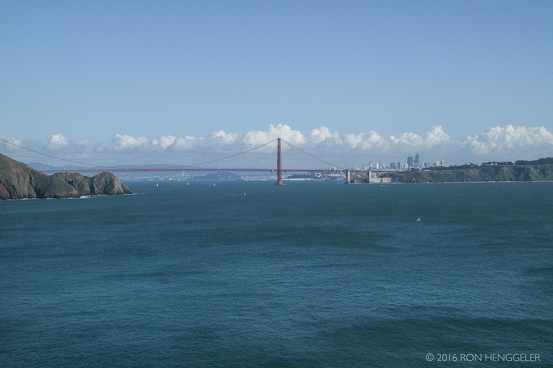
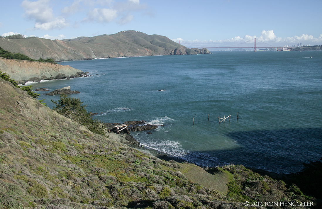
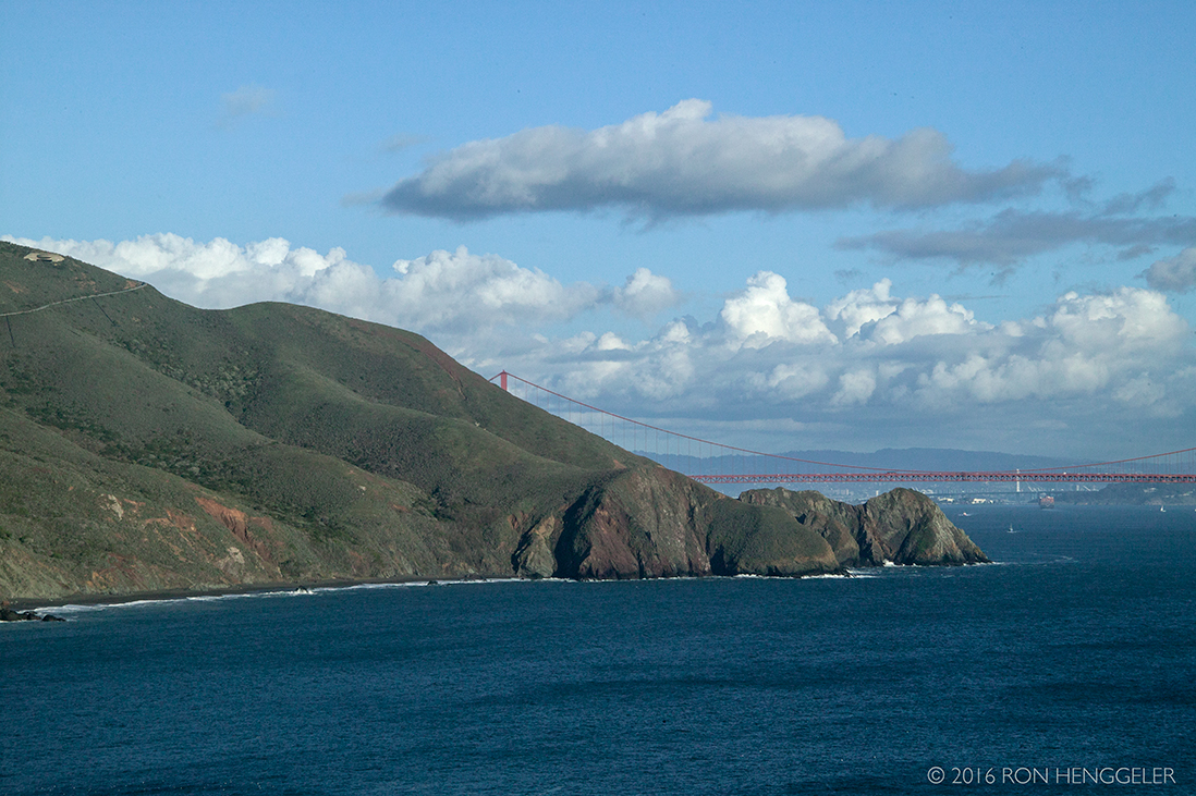
The view the Golden Gate and distant San Francisco from Hawk Hill in the Marin Headlands. |
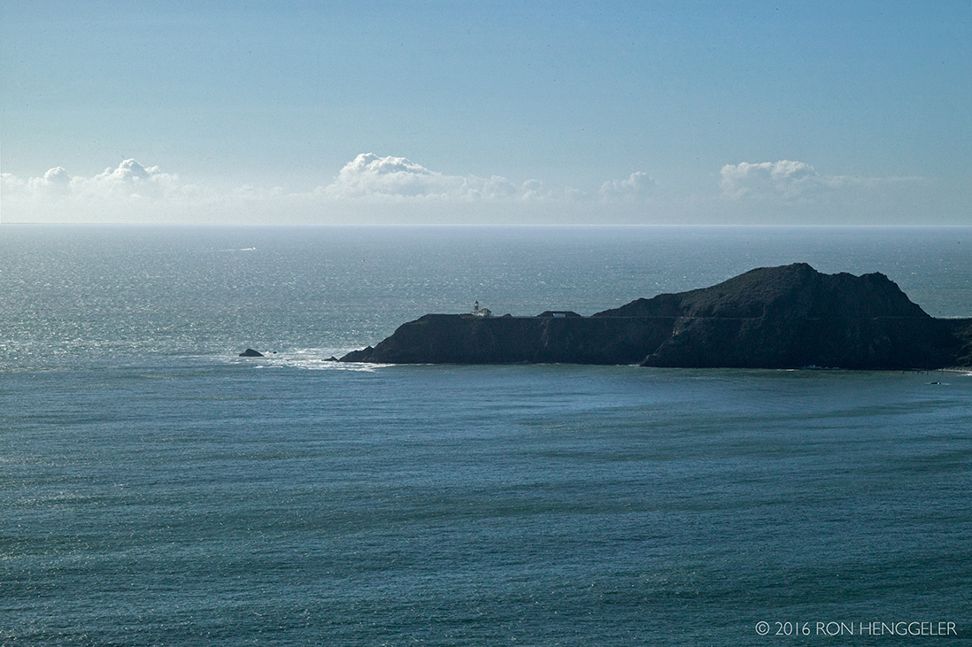
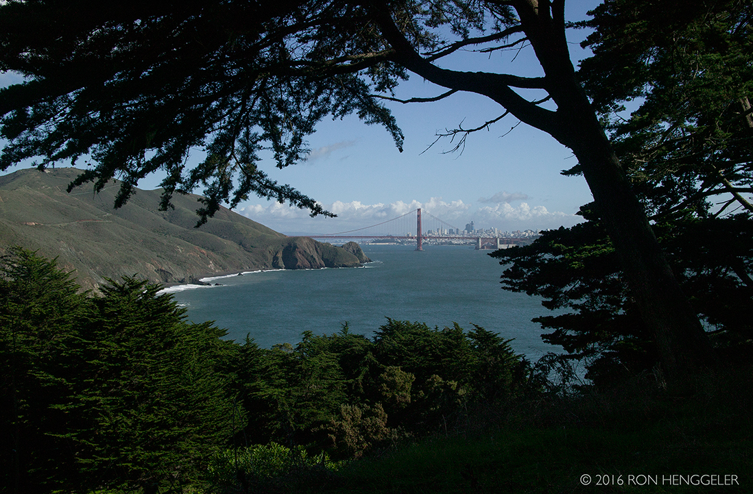
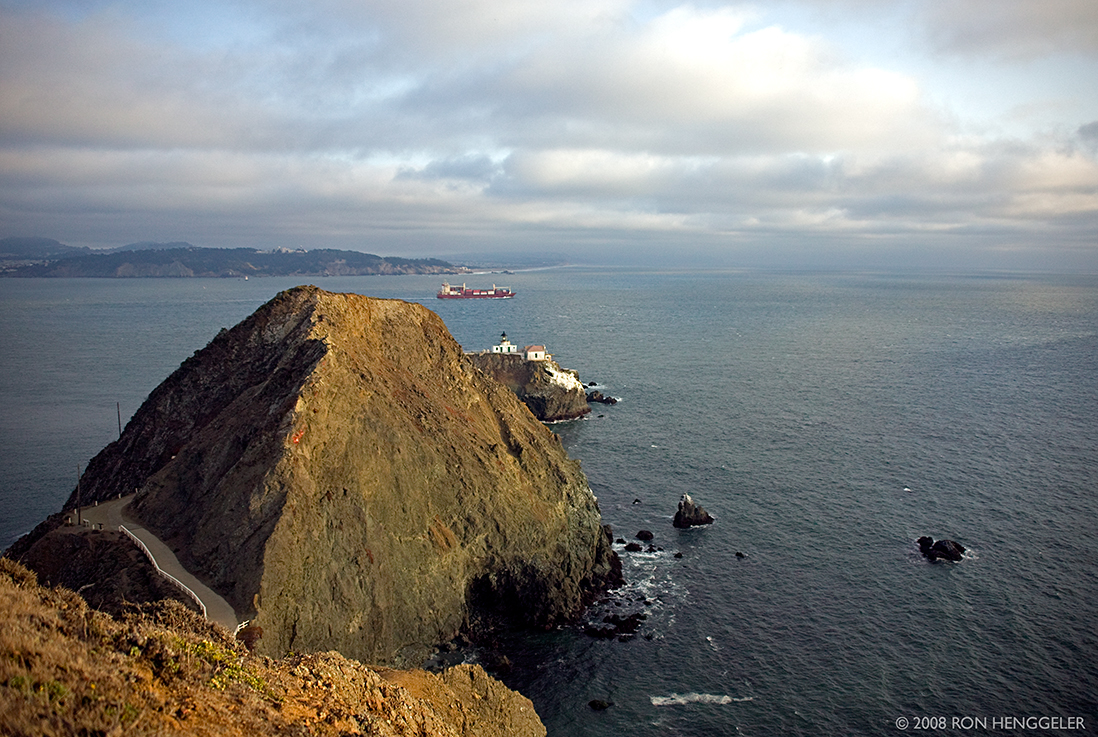
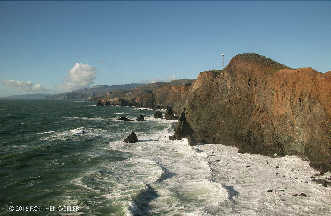
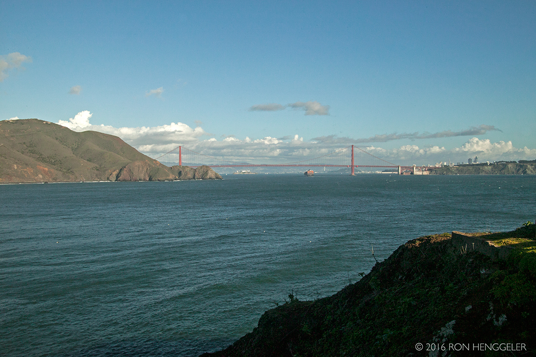
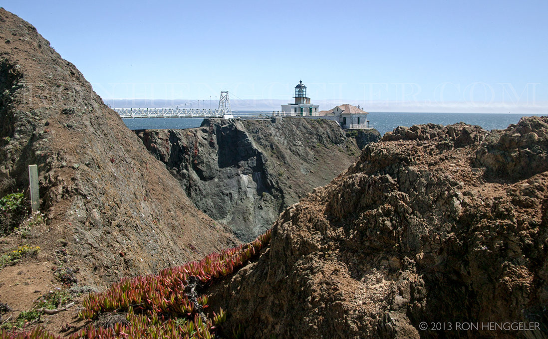
The distant Point Bonita Lighthouse viewed from on the Conzelman Road in the Marin Headlands.With the discovery of gold in 1848, California and the world changed forever. Soon, San Francisco became the main port for gold seek- ers from around the globe. In 1849, the city’s population leaped from 900 to 20,000!To lead the new settlers and explorers safely through the dangerous waters of the Bay entrance, a system of lighthouses developed. Alcatraz’s light showed the way for ships directly in front of the Golden Gate and Fort Point’s lighthouse marked the southern edge of San Francisco Bay, but another lighthouse was needed north of the Golden Gate to make the entrance recognizable for ships sailing up the coast from the south. That lighthouse site became Point Bonita.Point Bonita Lighthouse, the third lighthouse on the West Coast, was completed in 1855.https://www.nps.gov/goga/upload/sb-pobo.pdf |
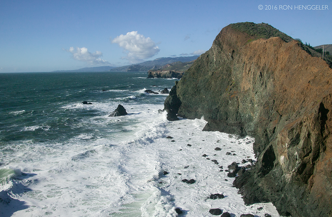
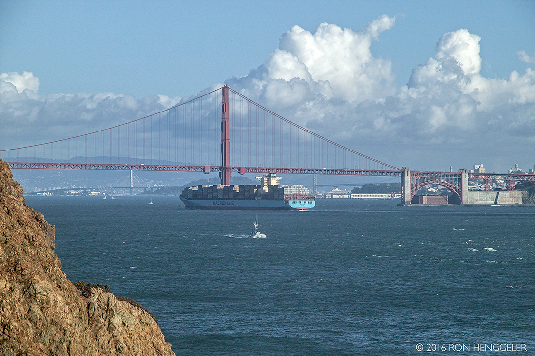
The Gate, and the distant Golden Gate Bridge viewed from Point Bonita |
|
|
|
|
|
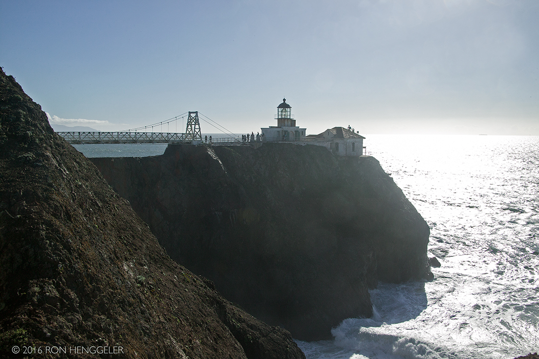
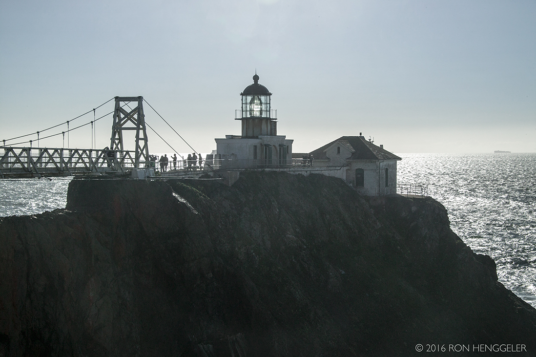
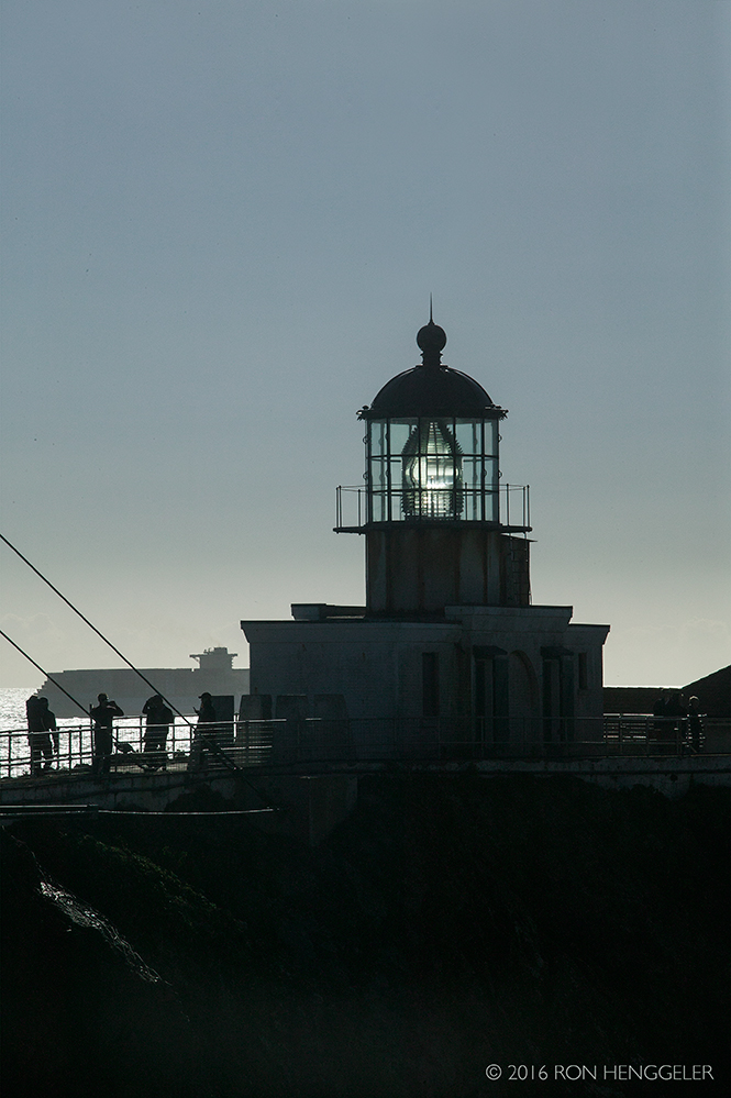
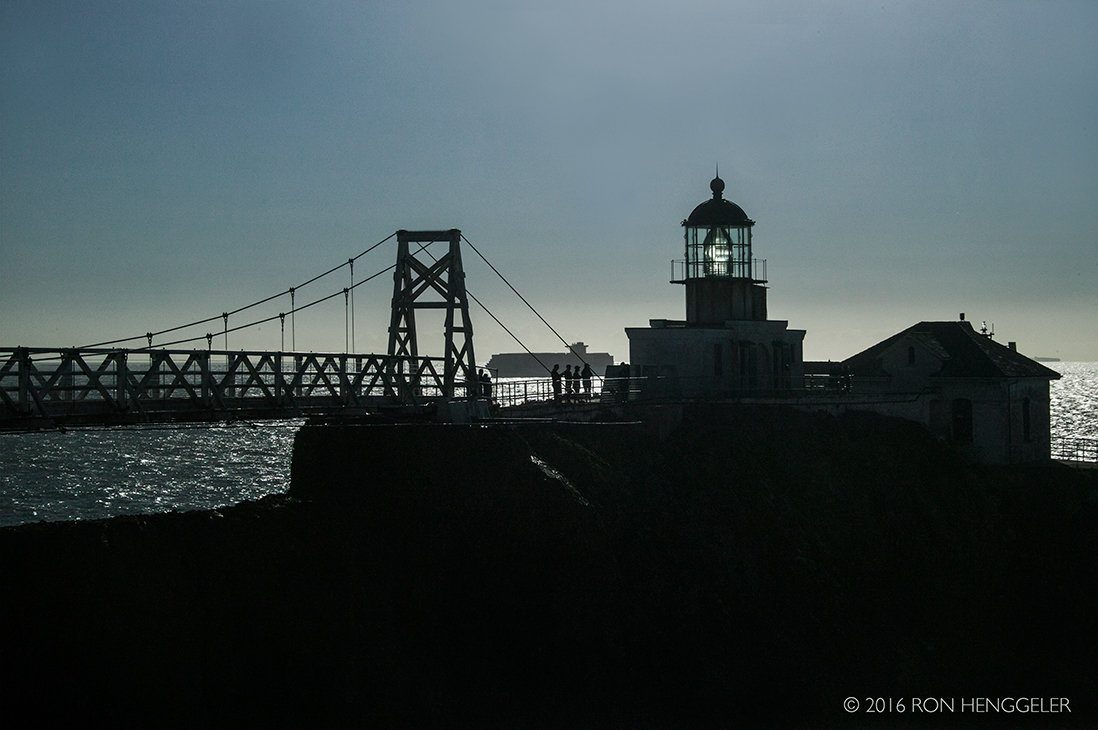
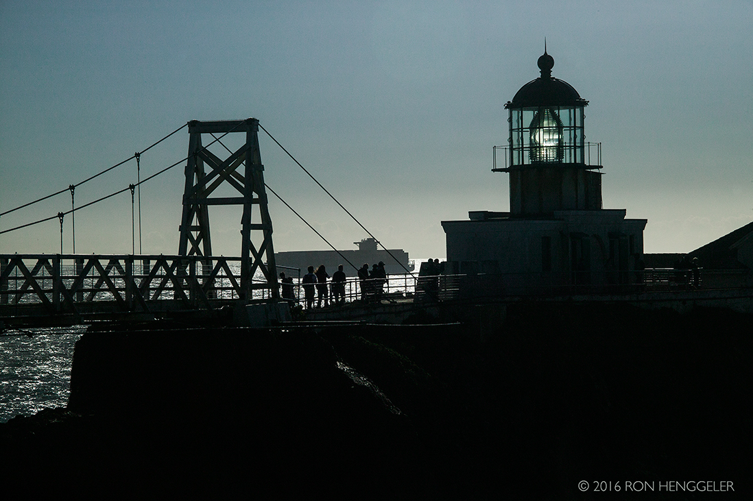
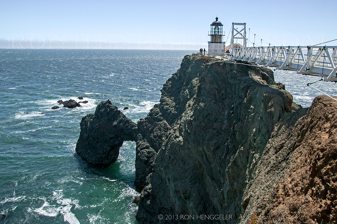
For over 150 years, Point Bonita Lighthouse has aided ships navigating the treacherous waters of the Golden Gate. It’s welcome beacon continues to greet both mariners and lighthouse visitors alike. Point Bonita Lighthouse is a lighthouse located at Point Bonita at the San Francisco Bay entrance in the Marin Headlands near Sausalito, California. Point Bonita was the last manned lighthouse on the California coast. |
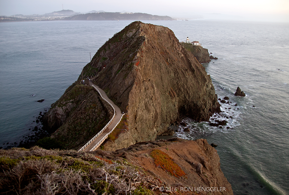
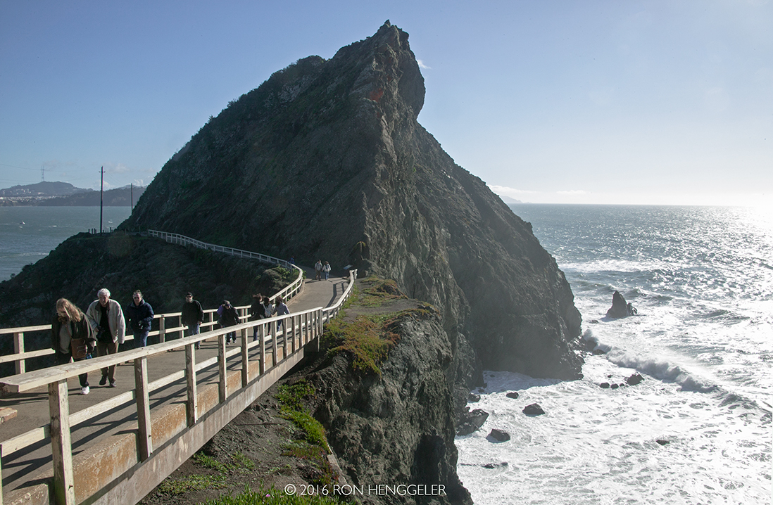
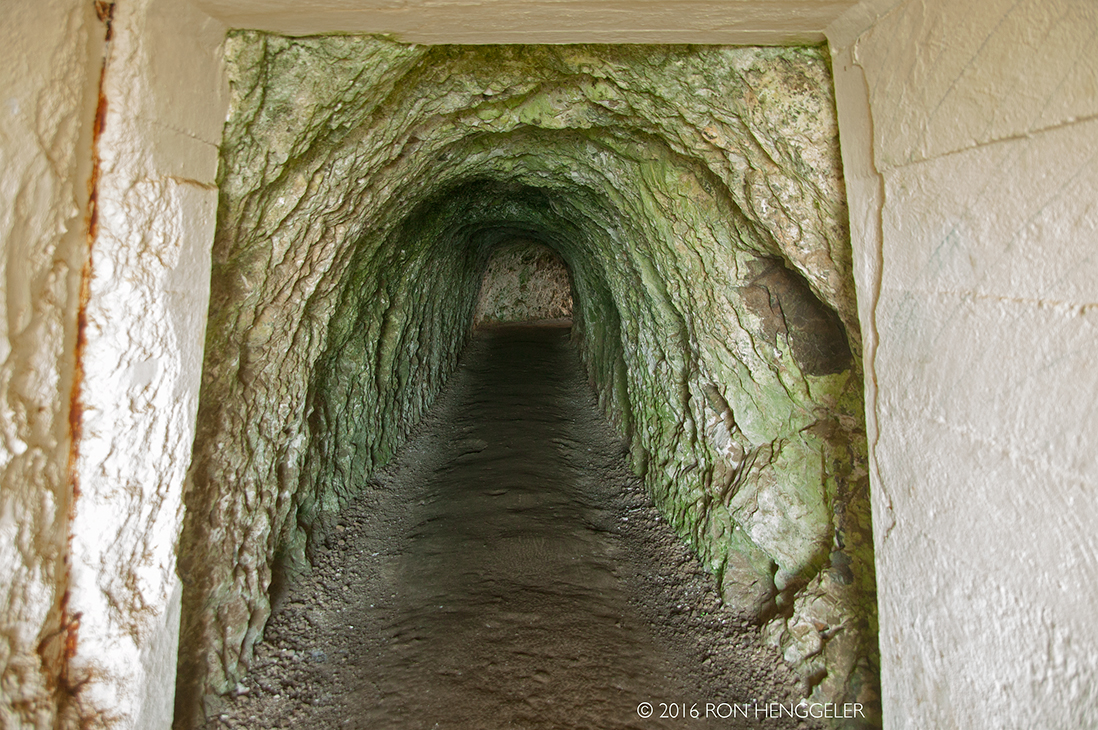
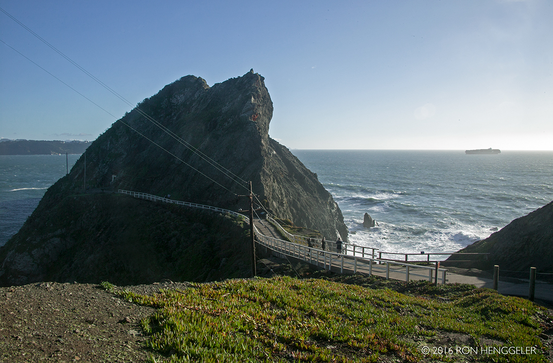
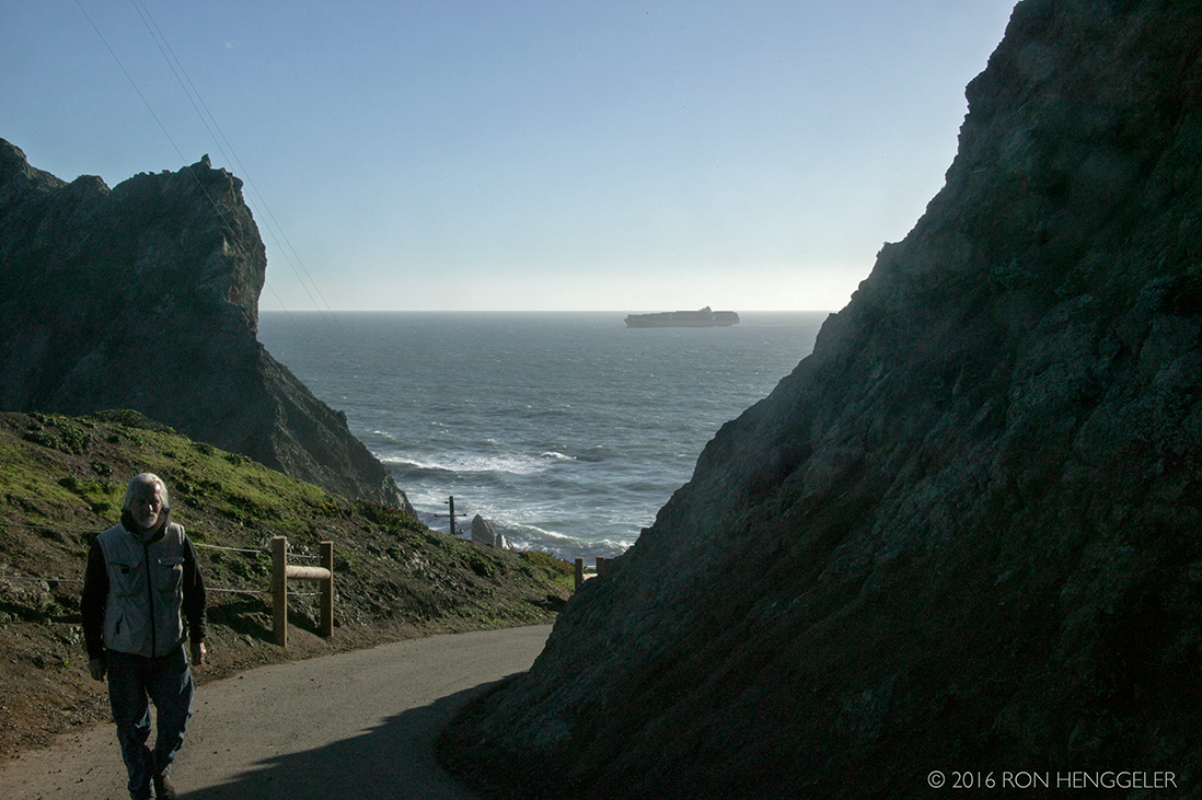
The Point Bonita Lighthouse is reached by a half-mile trail that is steep in parts. (On the left is the tunnel entrance that passes through the rock to the other side) |
Point Bonita is located at the northern entrance to the San Francisco Bay. The original name was in fact "Point Boneta" - a reference to the resemblance of the area hills to the hats worn by Spanish religious officials. (Early lighthouse plans are still labeled "Point Boneta.") In the early 1850's, when lighthouse construction began, there was still no marker at Point Bonita. In 1853 the steamship Tennessee ran aground just north of Point Bonita (at what is now Tennessee Cove). The clipper ship San Francisco struck the rocks of Point Bonita and sank in 1854. |
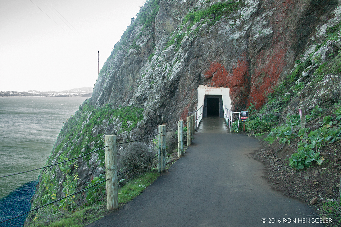
A view of the Golden Gate as seen from the trail leading into the tunnel on the way to the Bonita Lighthouse. |
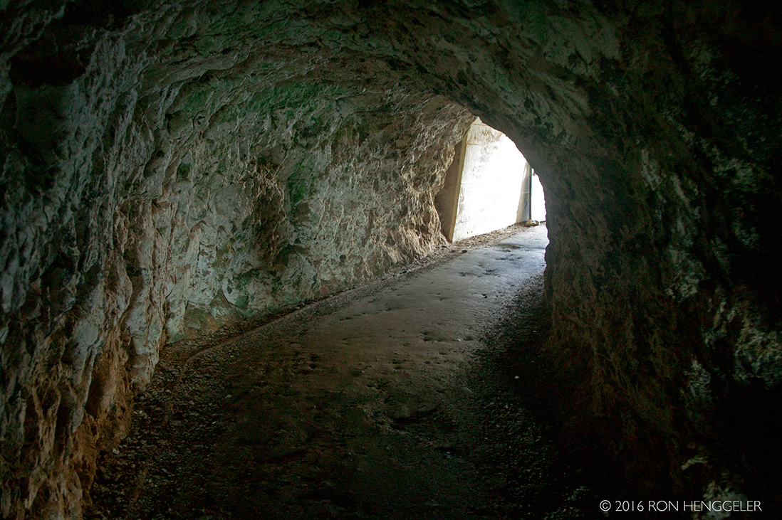
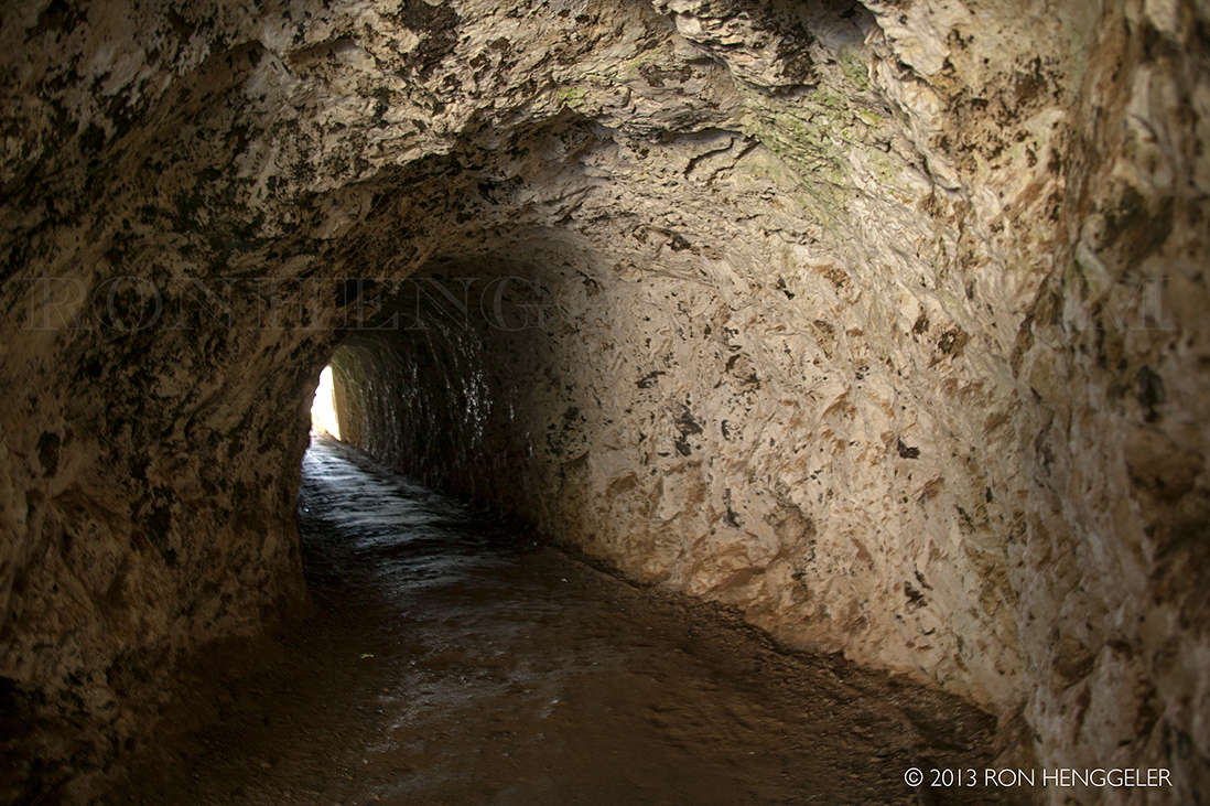
A tunnel was cut through the rock to allow more direct access to the point. |
In the late 19th century, Chinese laborers carved out this tunnel by hand. These were the same laborers who had built the western end of the Transcontinental Railroad in the 1860’s. |
|
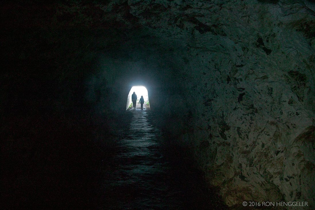
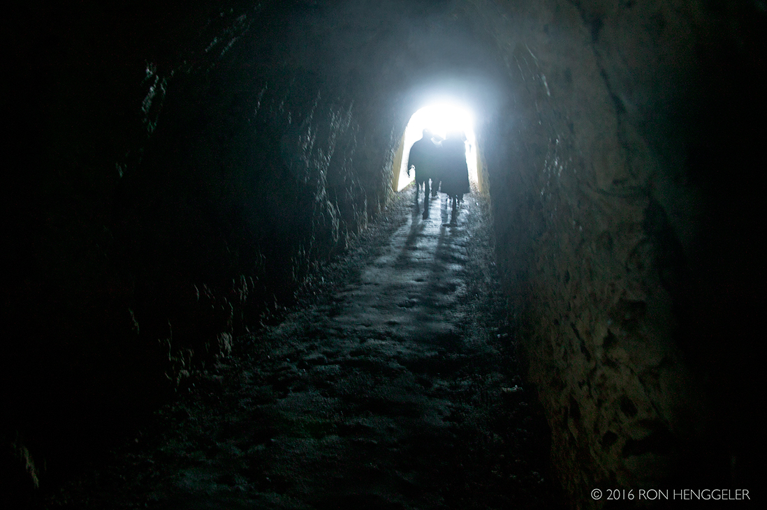
Inside the tunnel looking towards the direction of the lighthouse. |
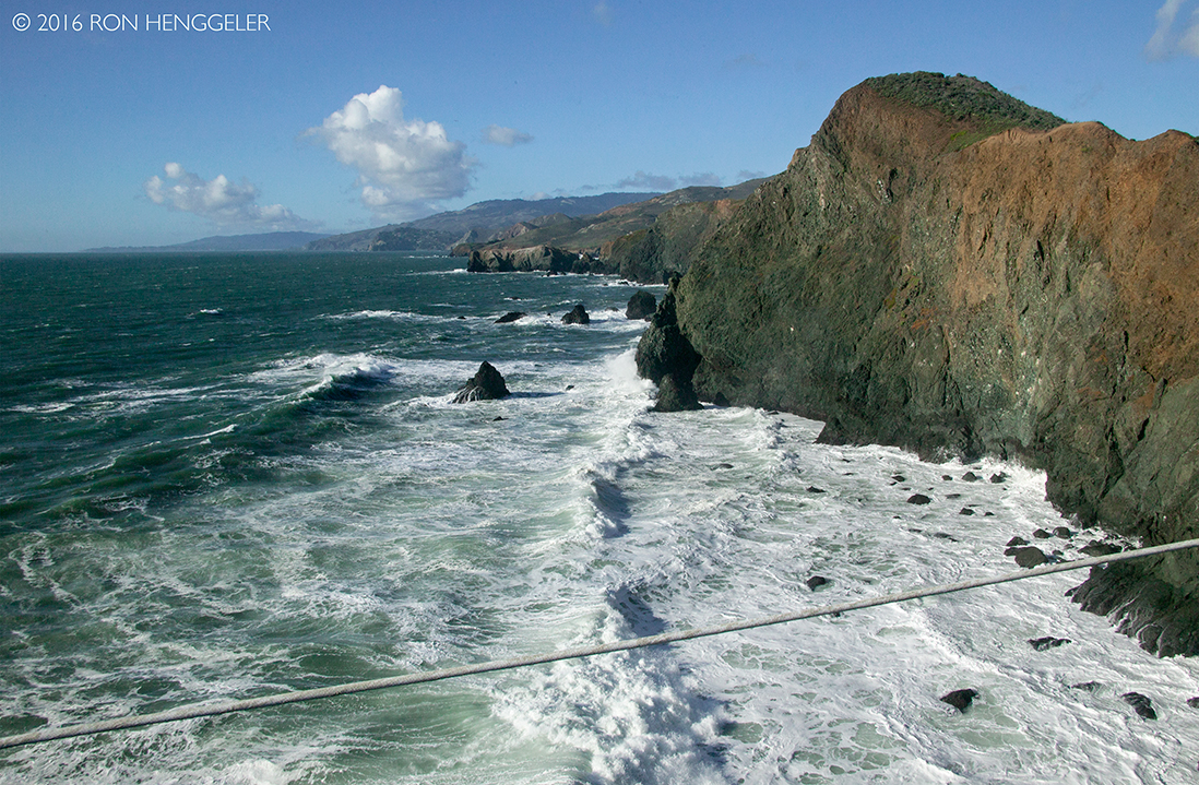
Once outside again, one is immediately in view of the lighthouse, and miles across across the watery Gate, the far-distant Point Lobos near the Cliff House on the San Francisco side of the Golden Gate. |
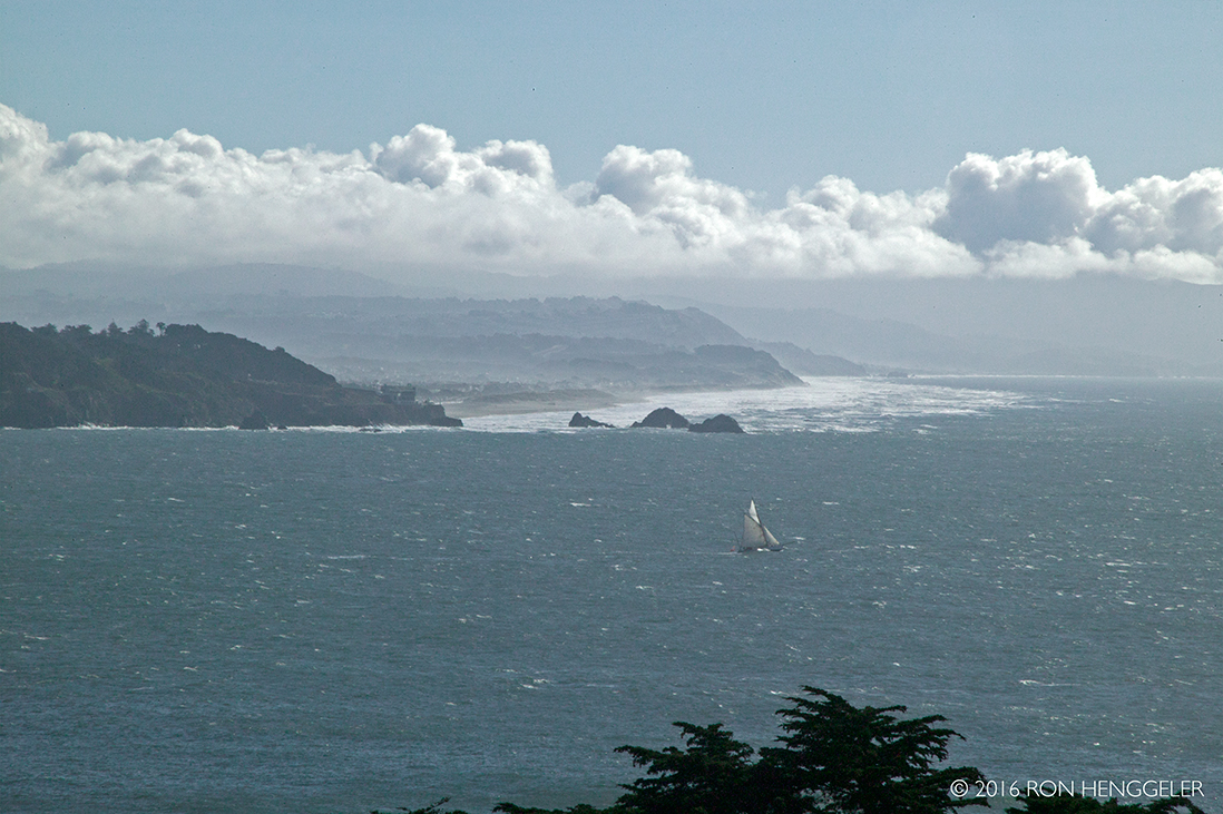
Point Lobos, Seal Rocks, and Ocean Beach, as seen from Point Bonita |
The tunnel halfway to the lighthouse is open only during visiting hours: Saturdays, Sundays and Mondays from 12:30 p.m. to 3:30 p.m. |
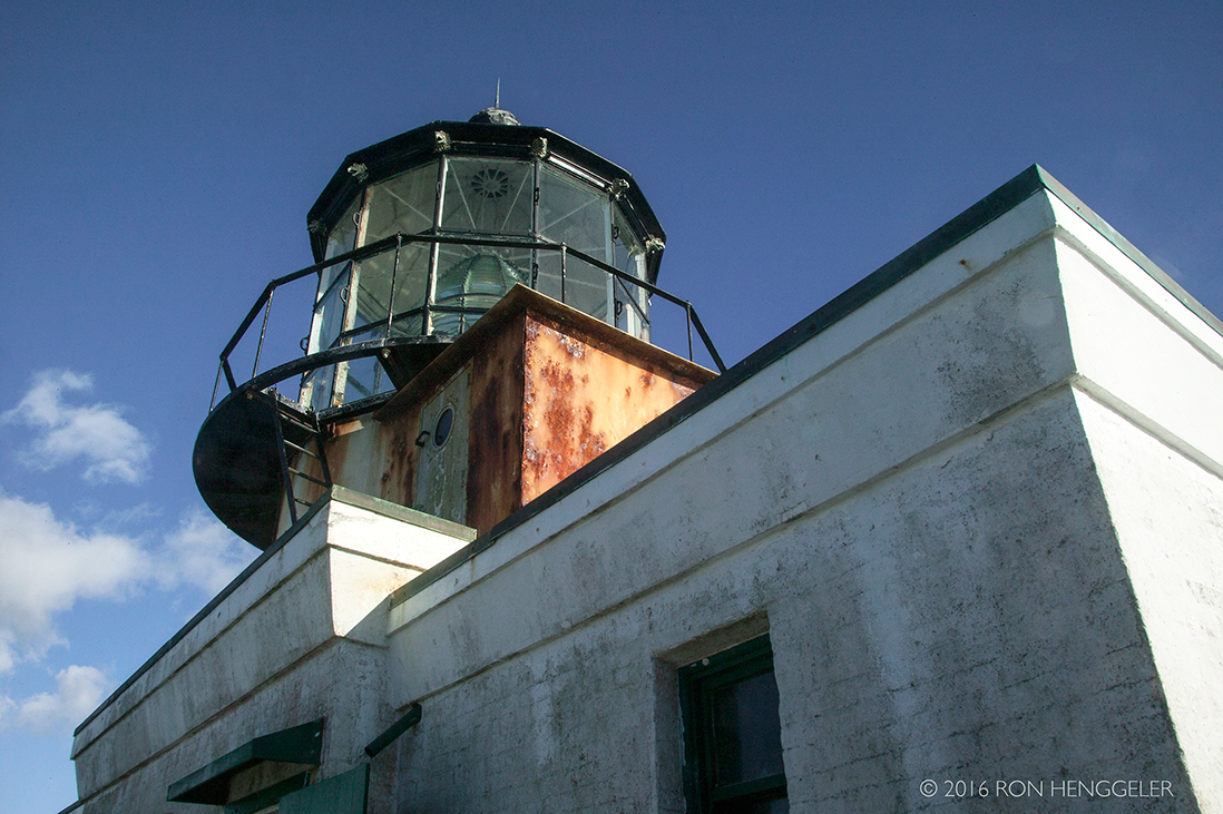
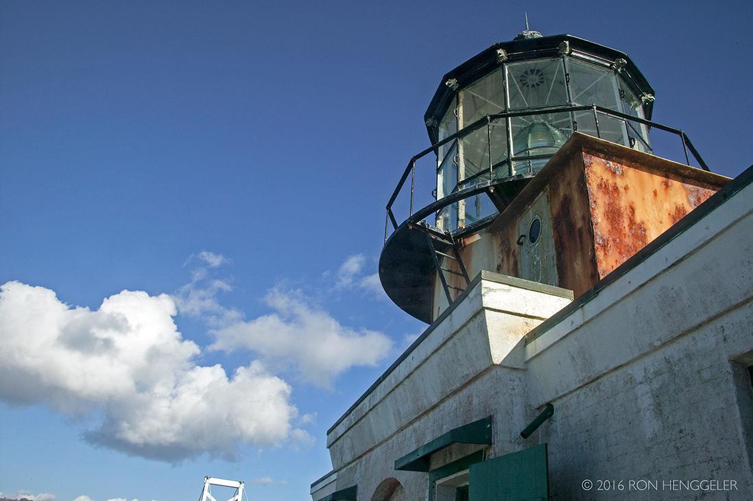
Point Bonita Lighthouse, the third lighthouse on the West Coast, was completed in 1855. Built upon a high ridge 300 feet above the water, there were soon complaints that thick fog frequently obscured the light beam. A new site at a lower elevation was chosen near- by at the tip of Point Bonita. Unstable rock made construction of a hand-hewn tunnel and trail to the site challenging. |
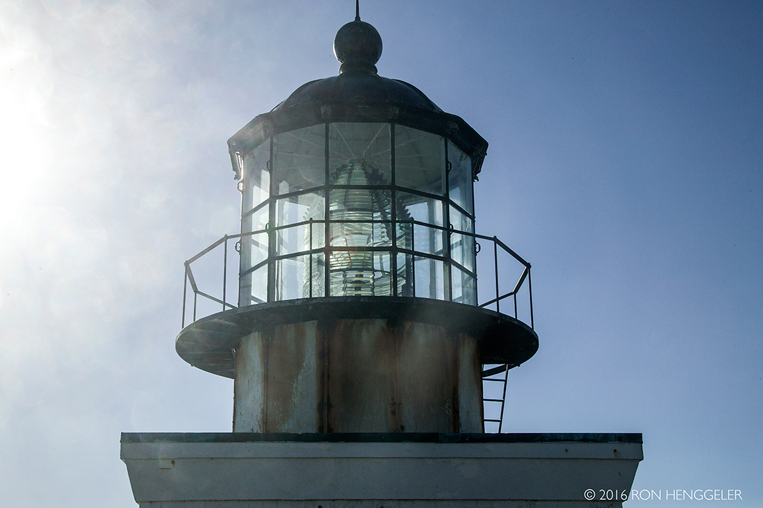
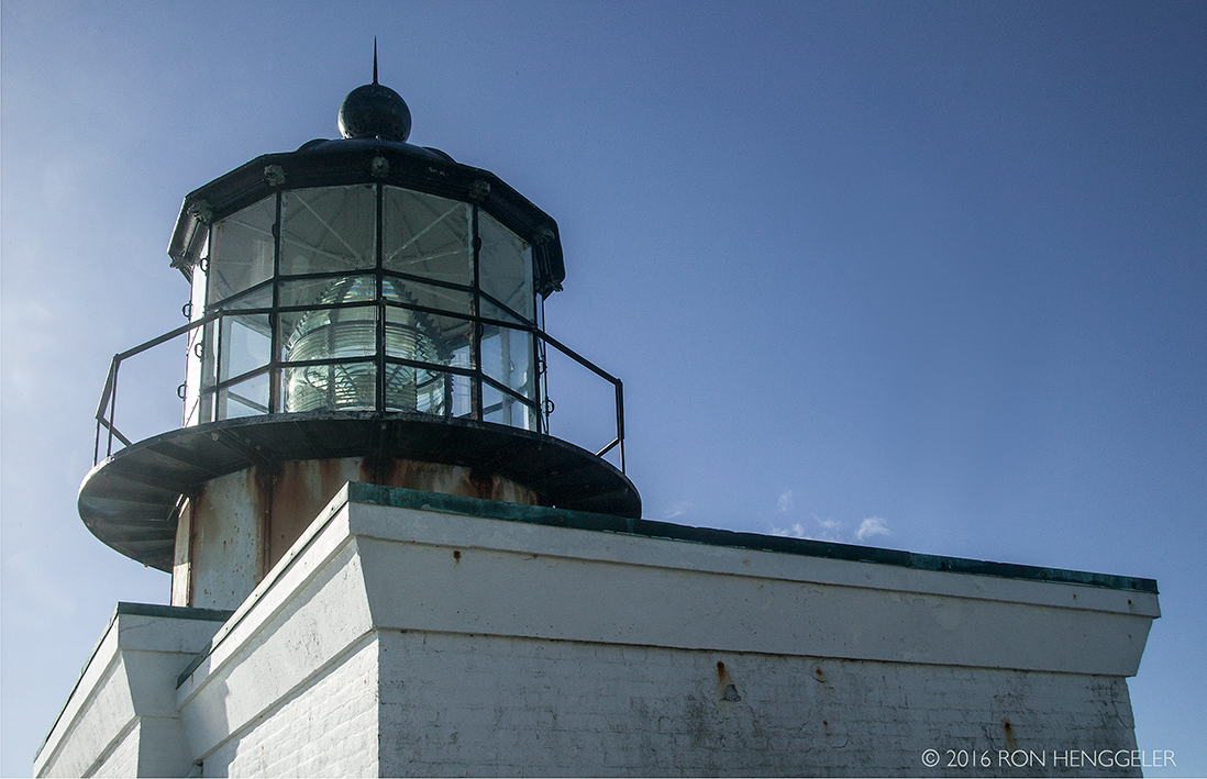
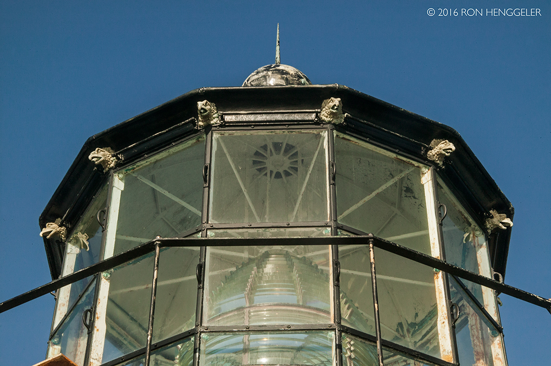
In 1854, difficult work began on a lighthouse situated on the highest hill in the area - 260 feet above sea level. The point was very difficult to reach. The point was at the top of 50-foot cliffs, and the breakers from the Pacific side of the point are quite powerful. The first local contractor backed out of the job. A second firm completed the task - a California-cottage style dwelling, with a separate tower. The 56-foot high tower housed a fixed second-order Fresnel lens, the most powerful beacon of the San Francisco Bay. The lamp was lit for the first time on May 2, 1855. |
As with many lighthouses of the area, fog was a major problem. High above the point, the lighthouse was often obscured by high fog. A surplus cannon was acquired from the Benicia Arsenal and a new keeper, Sgt. Edward Maloney, was hired to fire the cannon as a fog signal. The assignment proved very difficult, due to the frequency of fog in the area. Maloney once fired the cannon for three days, resting for only two hours. The cannon was also difficult to hear, and gunpowder was expensive. A fog bell with an automated clockwork was finally installed in 1856. |
Difficulties in sighting the original light led the Lighthouse Service in the 1870's to move the light from the top of the hill to Land's End - the far end of the point itself. This is the most difficult area of Point Bonita to traverse, due to its steep cliffs and narrow paths. Huge breakers and rockslides were not uncommon. The first difficult steps in building a new lighthouse involved simply cutting a path to Land's End! |
In the 1920's, Point Bonita's lamp was switched from a fixed to an osculating lens. An eclipser was installed within the lens which would block out the light at regular intervals. |
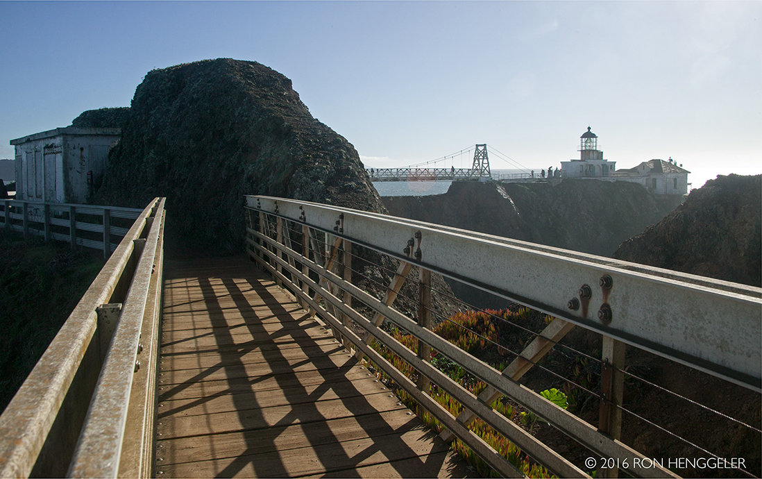
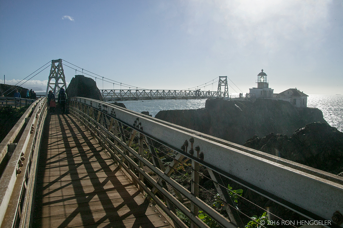
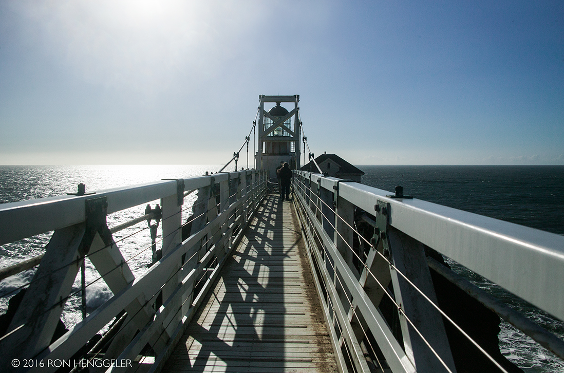
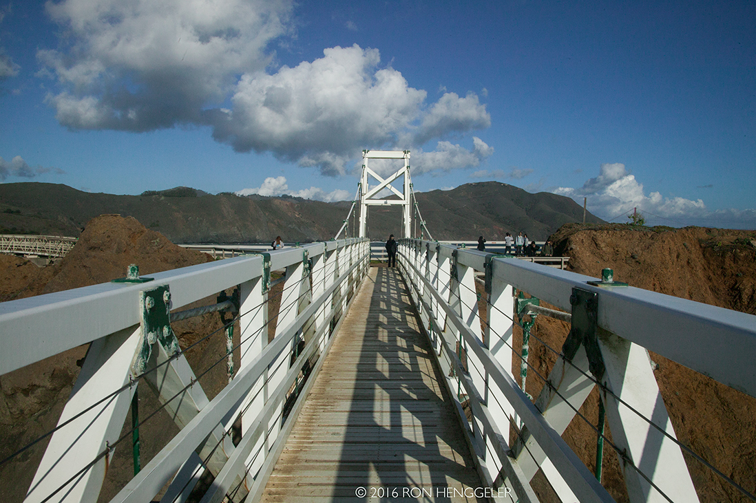
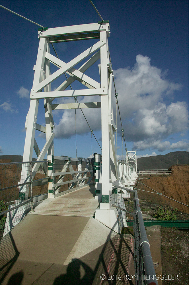
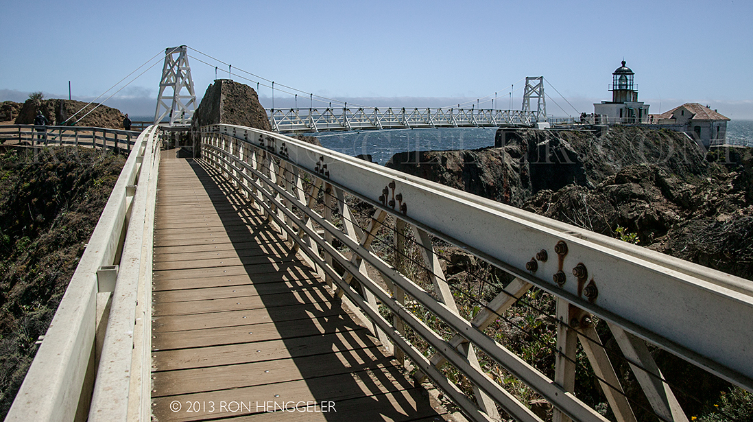
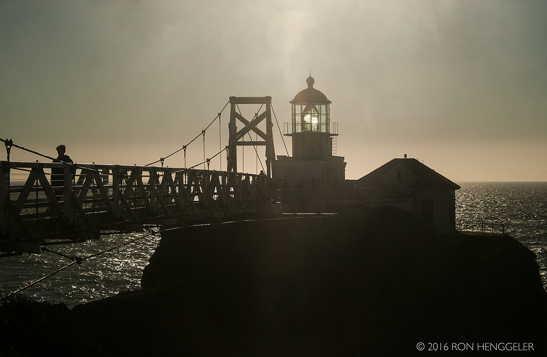
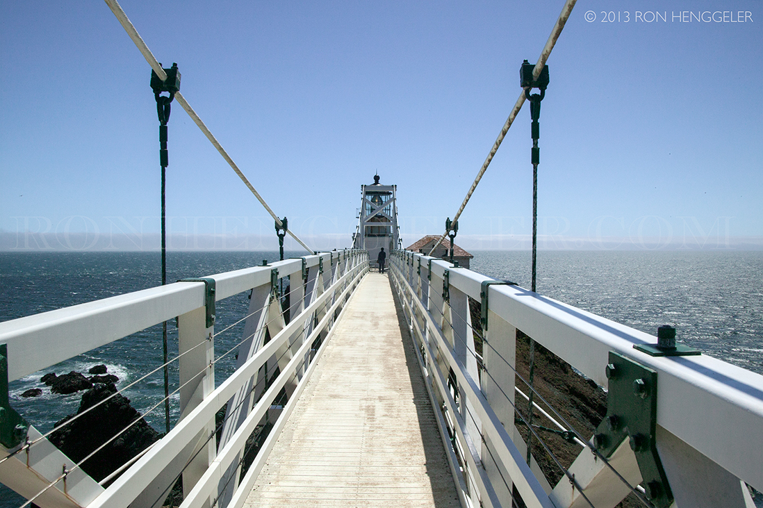
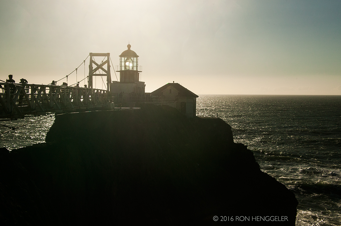
Up until 1940 the lighthouse could be reached without a bridge, but erosion caused a trail leading to the lighthouse to crumble into the sea. A wooden walkway was installed, but when that became treacherous the suspension bridge was built in 1954. |
|
In the 1960's, the Coast Guard closed the station to the public. Compressed air horns had long replaced the old fog signals. By 1979, Point Bonita was the last manned lighthouse in California. The light was automated shortly afterwards. The station, while still maintained by the Coast Guard, was handed over to the National Parks Service as Park of the Golden Gate National Recreational Area. The Parks Service re-opened the station to visitors. The original second-order Fresnel lens still graces the tower. |
|
A view on the south side of the Point Bonita Lighthouse |
|
A view from the bridge near the lighthouse, looking north towards Tennessee Valley, Muir Beach, Stinson Beach, Bolinas, and Point Reyes over 30 miles away up the coast |
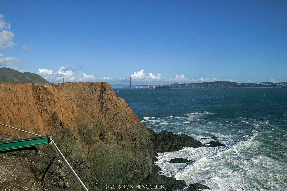
A view on the bridge from the south side of the Point Bonita Lighthouse looking east to the Golden Gate Bridge and San Francisco |
|
|
|
|
Difficulties in sighting the original light led the Lighthouse Service in the 1870's to move the light from the top of the hill to Land's End - the far end of the point itself. This is the most difficult area of Point Bonita to traverse, due to its steep cliffs and narrow paths. Huge breakers and rockslides are not uncommon. |
|
|
|
|
|
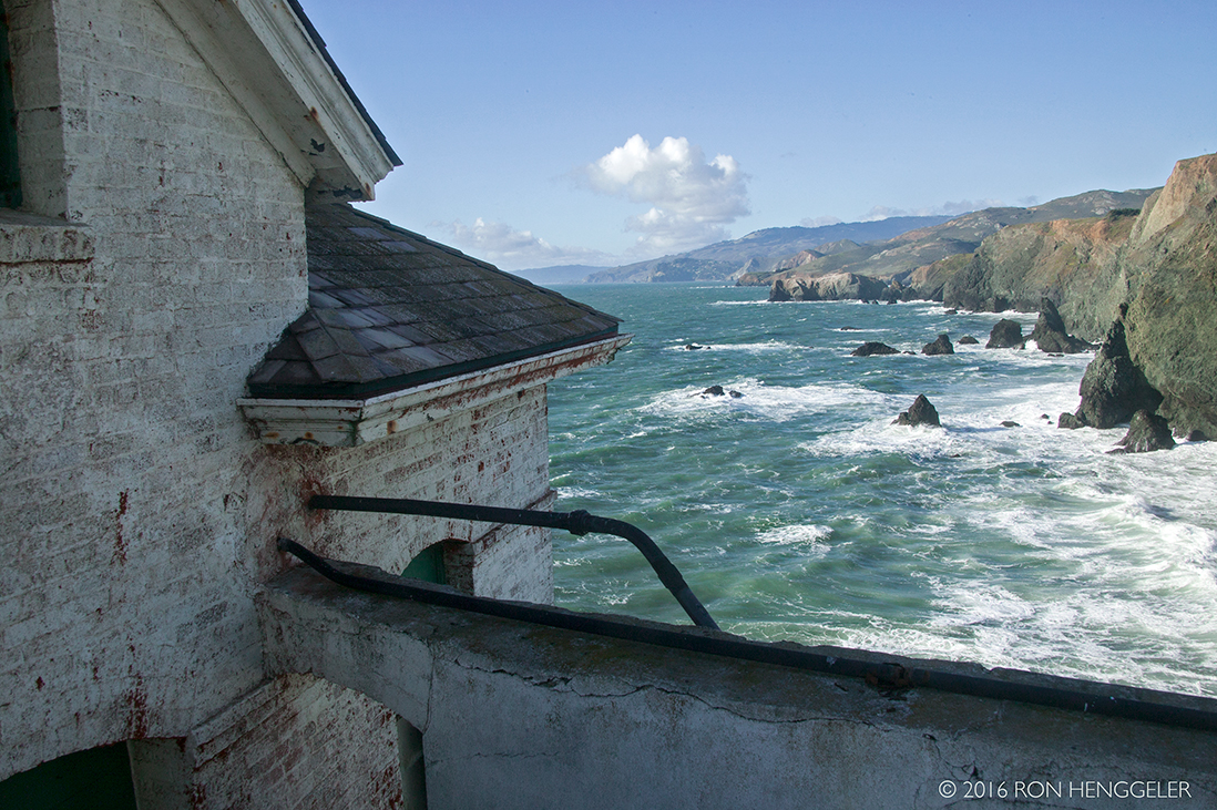
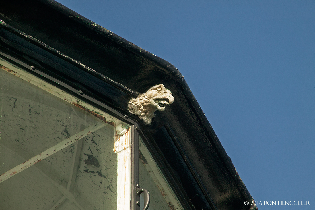
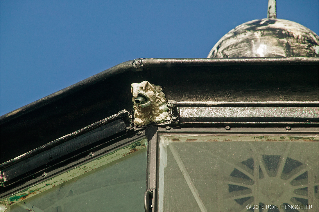
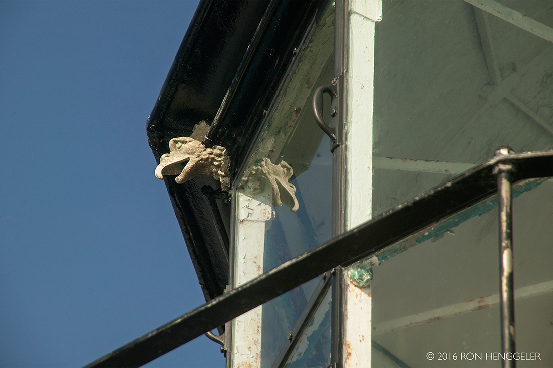
Susan, a volunteer guide and attendant at the lighthouse, told me that the gutter-spout gargoyles on the roof of the lighthouse were made in France. |
|
|
|
|
|
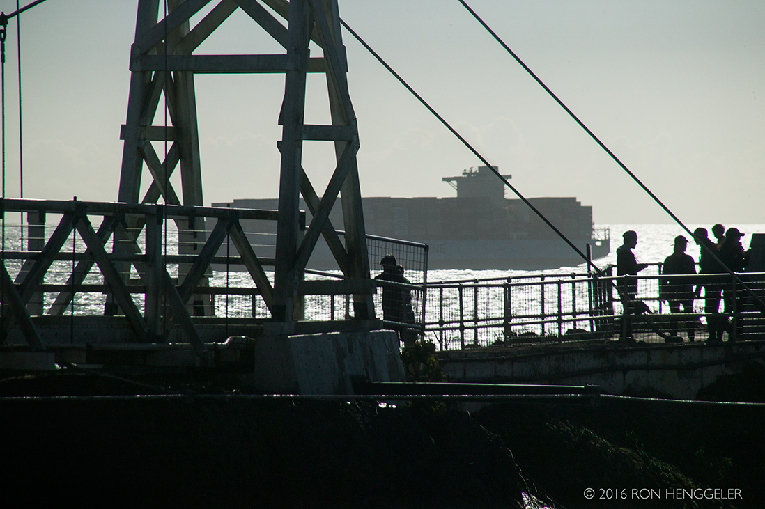
The view looking down to the water on the south side of the lighthouse. At low tide on calm days, kayakers pass through the natural archway in this stand of rock. In the early 1940's a particularly violent storm washed out the narrow path between the lighthouse and the rest of Point Bonita. A wooden causeway was built to bridge the gap. This was replaced by a suspension bridge, which still stands. (At present, park personnel stand at both ends of the ridge to ensure that no more than five people are on the bridge at any given time.) |
|
|
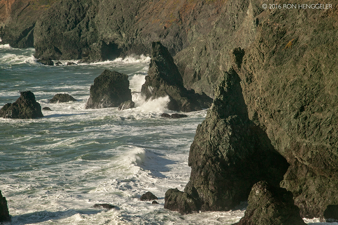
Despite the effectiveness of the lighthouses, over 300 boats ran aground near the Golden Gate during the gold rush years. The worst maritime disaster occurred in 1901, when the steamer City of Rio de Janeiro struck Point Diablo, near Point Bonita. Despite approaching in darkness and continued fog, the pilot was pressured by an influential passenger to proceed. The lives of 128 passengers were lost when the City of Rio de Janeiro struck rocks, quickly filled with water and sank to the bottom of the Bay. |
|
|
|
|
|
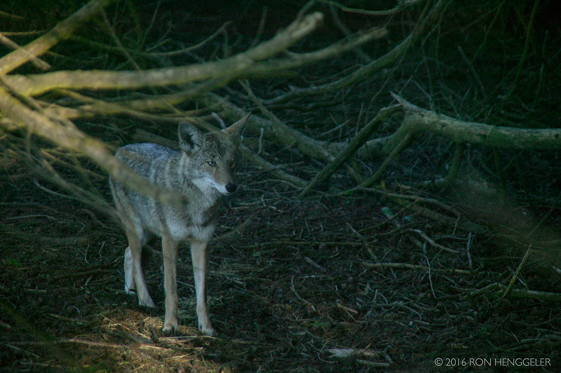
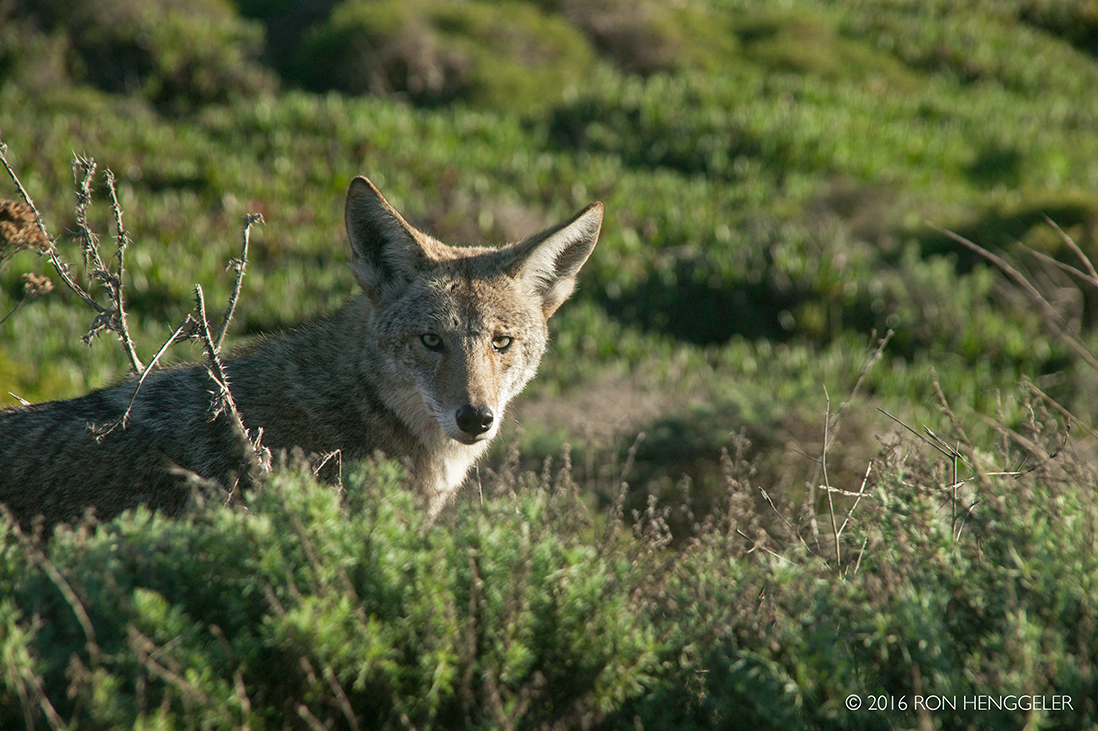
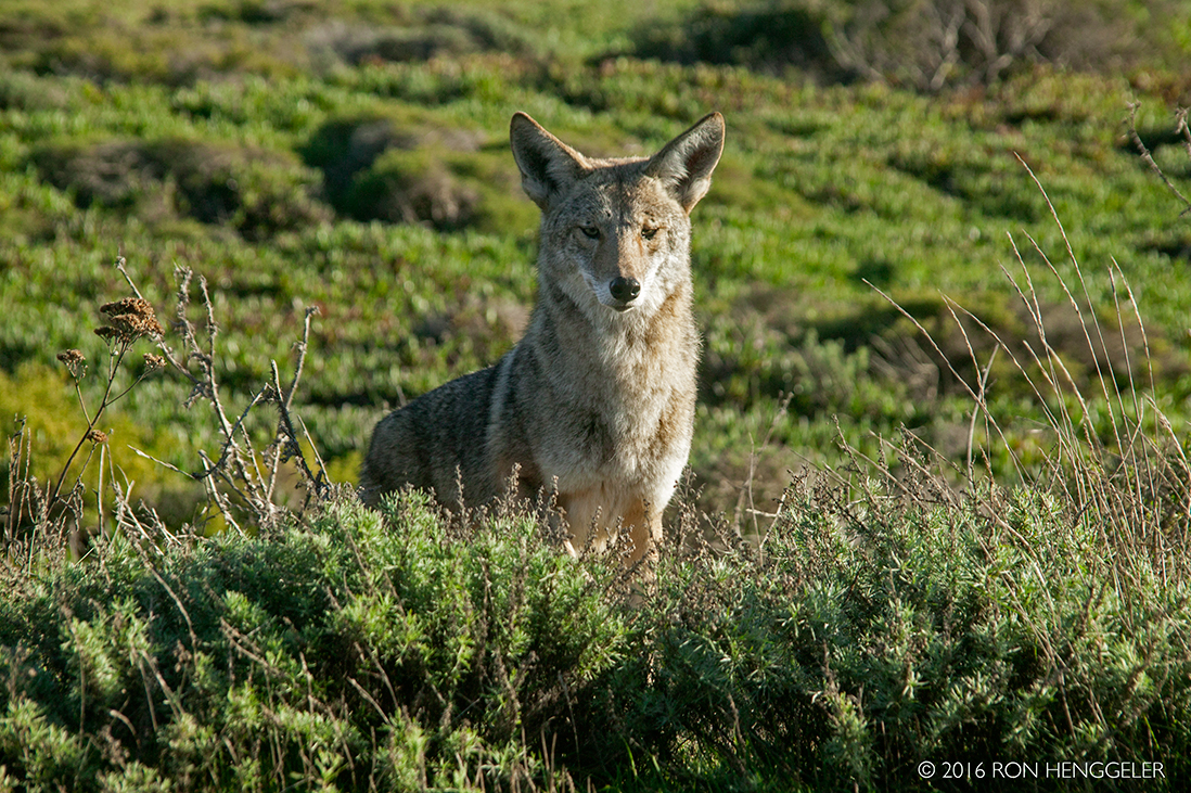
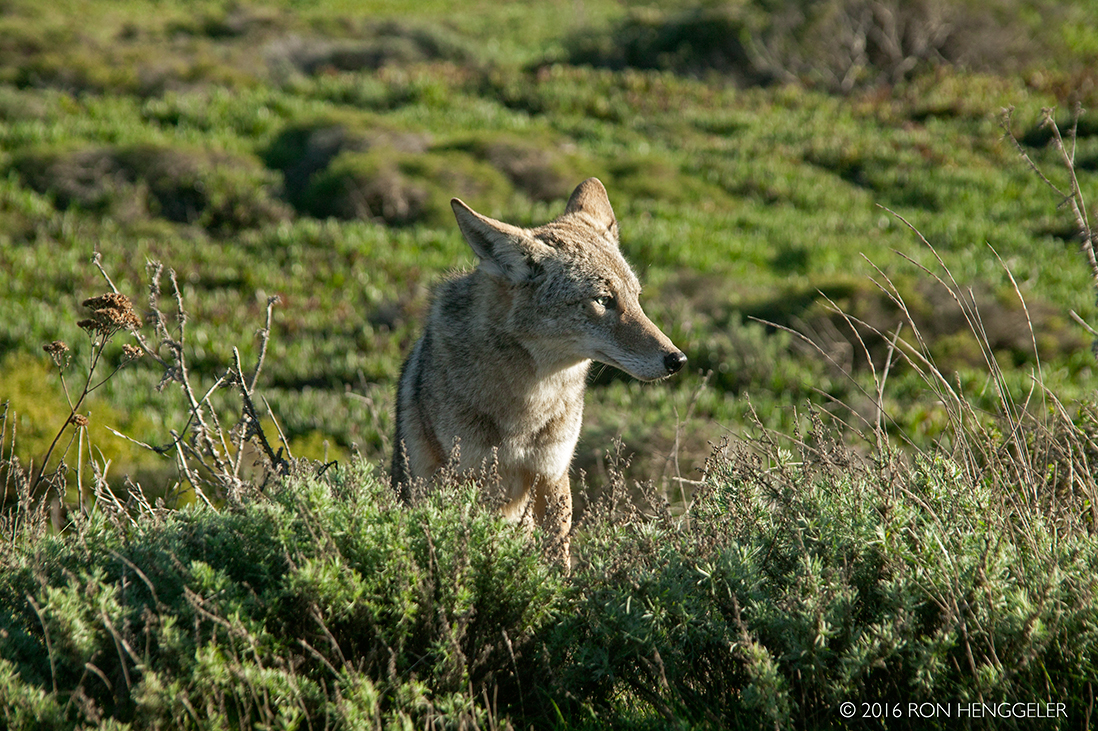
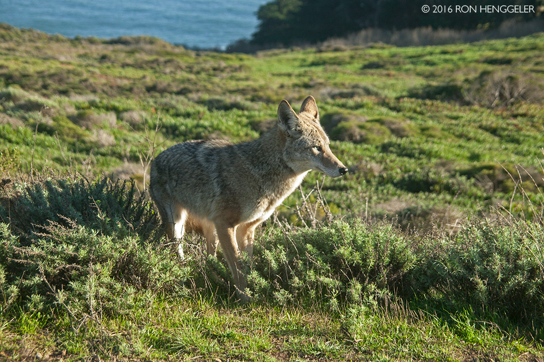
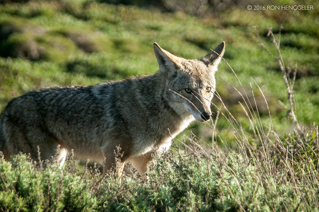
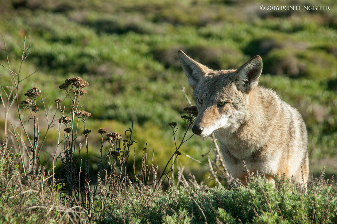
While walking along the coastal ridge trail after visiting the lighthouse, we chanced upon a coyote. |
At first she was a little cautious and apprehensive of Dave and I. |
When I began to photograph her, it seemed that she might suddenly bolt into the brush and disappear. |
But she stood her ground and let me take many more photos. (She's probably been fed by other visitors to the Marin Headlands and was hoping for a handout from me.) |
|
|
|
|
|
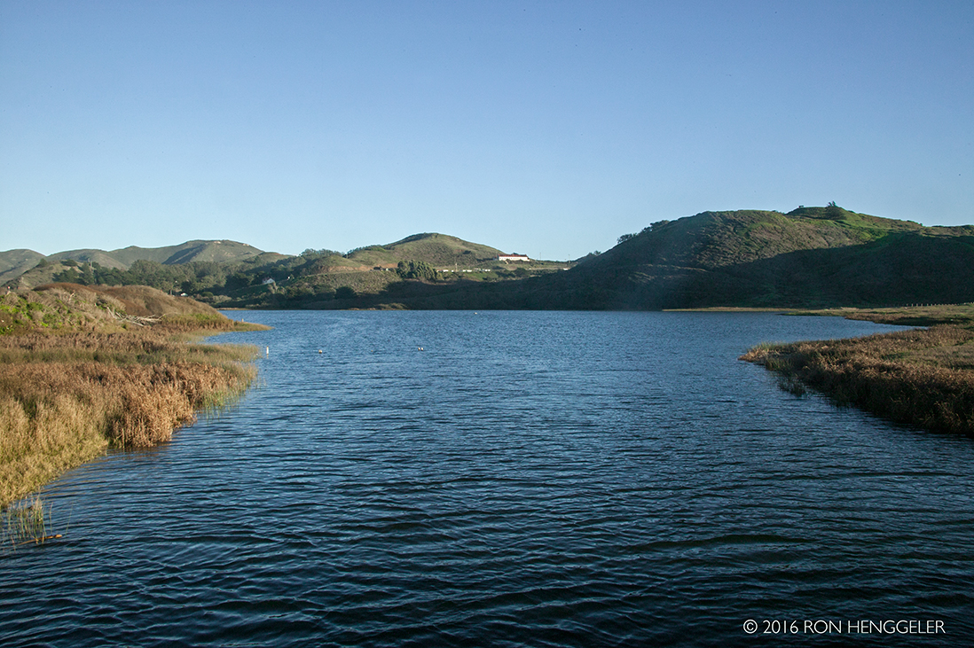
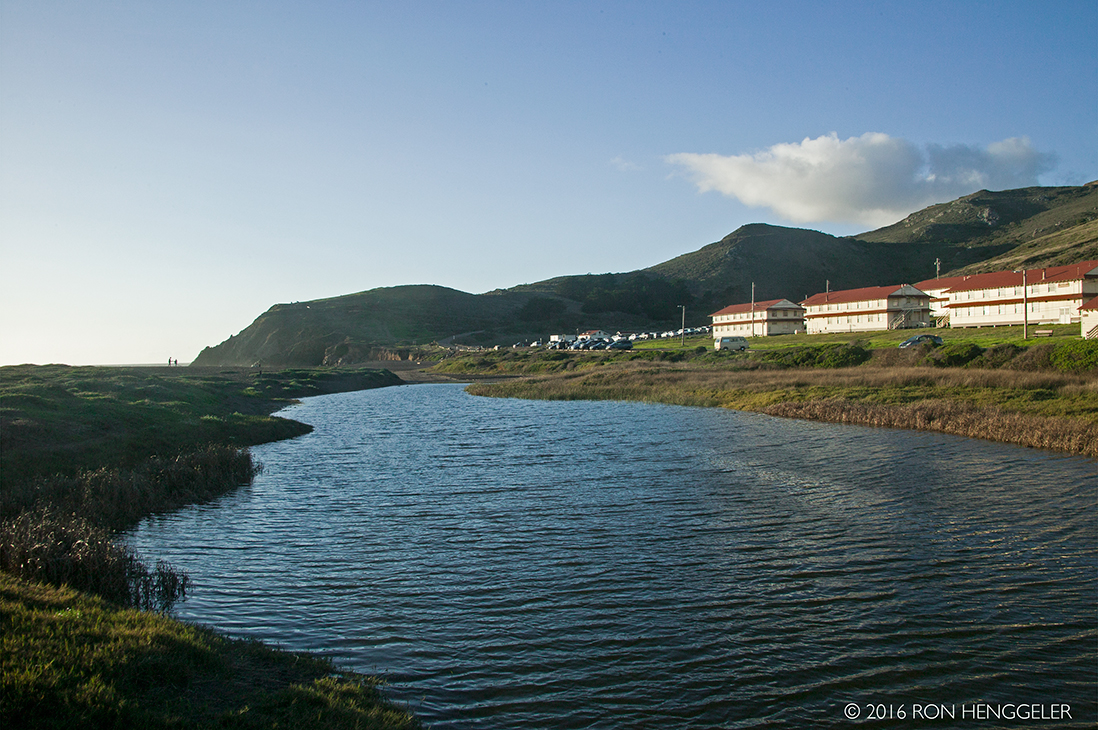
A view of Rodeo Lagoon.After our visit to the Point Bonita Lighthouse we drove to the nearby Rodeo Beach with the idea of walking the trails to Battery Townsley to watch the sun go down. |
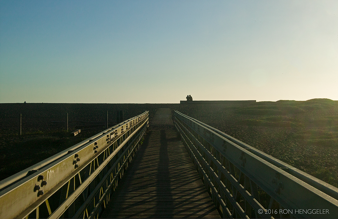
Once outside though, the fierce wind coming across the beach from the surf was biting cold and we weren't up to the task. We walked the bridge across the lagoon to the sandy beach but immediately returned to the van. |
|
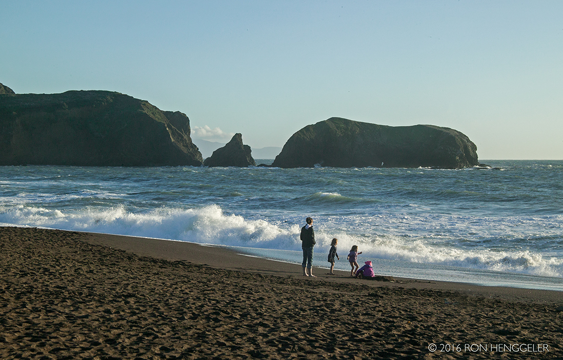
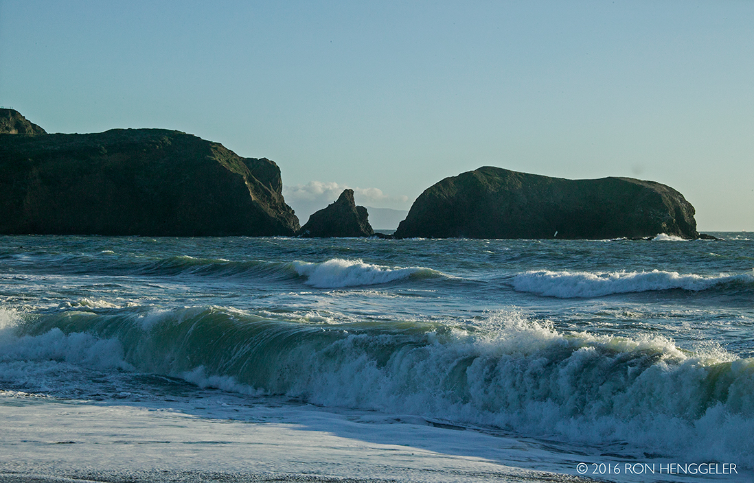
A view of Bird Rock from Rodeo Beach. The Point Bonita Lighthouse is to the south behind Bird Rock and the stand of coastal cliffs. |
|
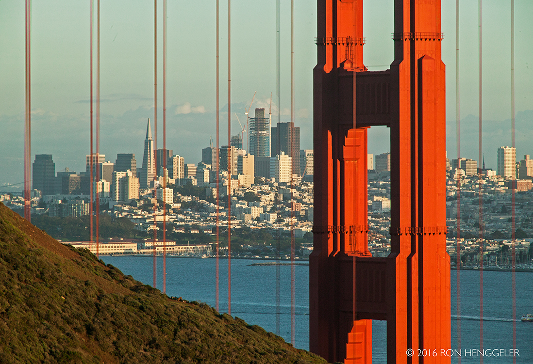
Late in the day, while leaving the Marin Headlands after our visit to the Point Bonita Lighthouse, I stopped to take this photo of San Francisco through the cables of the Golden Gate Bridge. |
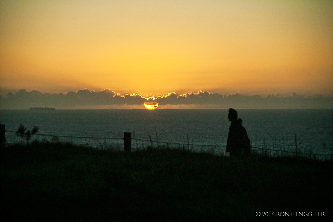
A photo of the sunset from Lincoln Blvd in the San Francisco Presidio |
“There are only two ways to live your life. One is as though nothing is a miracle. The other is as though everything is a miracle.”Albert Einstein |

Newsletters Index: 2017, 2016, 2015, 2014, 2013, 2012, 2011, 2010, 2009, 2008, 2007, 2006
Photography Index | Graphics Index | History Index
Home | Gallery | About Me | Links | Contact
© 2017 All rights reserved
The images are not in the public domain. They are the sole property of the
artist and may not be reproduced on the Internet, sold, altered, enhanced,
modified by artificial, digital or computer imaging or in any other form
without the express written permission of the artist. Non-watermarked copies of photographs on this site can be purchased by contacting Ron.